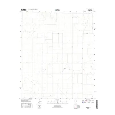
2016 Map of Tahoka SW
USGS Topo · Published 2016About this map
L P Askew Farms Airport sits as a lonely marker of aviation within this high plains agricultural landscape of Lynn County. The 2016 survey reveals a disciplined grid of rural roads, including Edward Rd and Fm 3112, defining vast rectangular sections of land. This region is characterized by numerous small, ephemeral lake beds or playas scattered across the terrain, which dictate the slight deviations in the otherwise straight paths of Co Rd 28 and Co Rd 30. The transition from local connectors like Co Rd 32 to state-maintained routes such as Fm 213 illustrates the infrastructure supporting the local farming economy. While settlements are absent from this specific quadrangle, the precise naming of family-related landmarks and county thoroughfares provides a clear picture of contemporary land ownership and rural navigation in West Texas.
Find a feature on this map
17 named features on this map. Tap any name to fly to it.
Don’t see what you’re looking for? This feature index may not catch every label — zoom into the map to look around manually.
Map Details
Editions of this 2016 Tahoka SW Map
This is the sole edition of this map. No revisions or reprints were ever made.
Other maps of this area

1954 · Lubbock
USGS Topo · 1:250,000

1954 · Hobbs
USGS Topo · 1:250,000

1954 · Big Spring
USGS Topo · 1:250,000

1954 · Brownfield
USGS Topo · 1:250,000

1958 · Brownfield
USGS Topo · 1:250,000

1958 · Big Spring
USGS Topo · 1:250,000

1958 · Hobbs
USGS Topo · 1:250,000

1962 · Brownfield
USGS Topo · 1:250,000

1969 · Welch East
USGS Topo · 1:24,000

1969 · Mound Lake
USGS Topo · 1:24,000