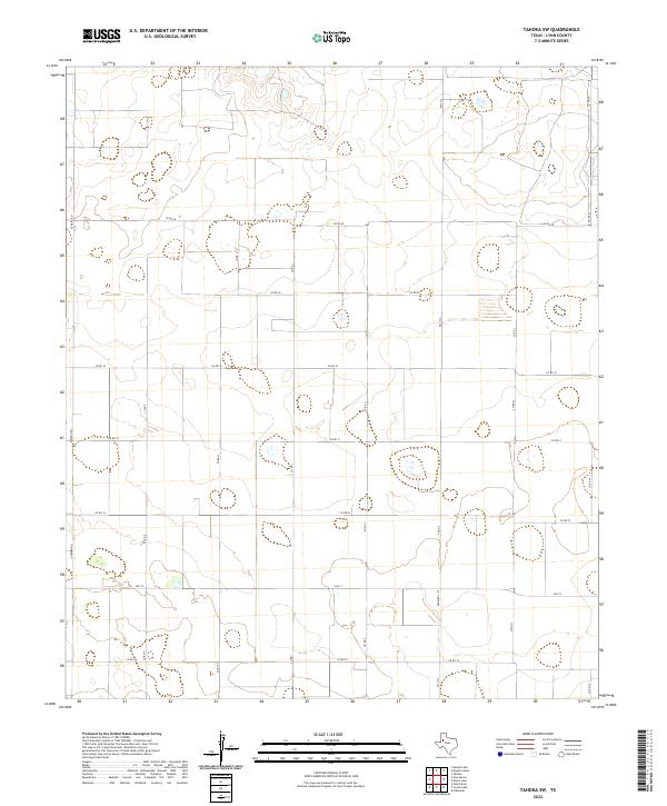
2022 Map of Tahoka SW
USGS Topo · Published 2022About this map
The High Plains of Lynn County, Texas, are characterized here by a strictly regulated grid of section lines and transport routes. This modern survey from the U.S. Geological Survey reveals a landscape defined by industrial-scale agriculture and a sparse network of farm-to-market roads. Notable paved arteries such as Fm 213 and Fm 3112 (also labeled as Farm Rd 3112) bisect the territory, connecting isolated farmsteads and agricultural operations. The terrain is marked by numerous ephemeral lakes and depressions, a signature feature of the Llano Estacado. Local connectivity is maintained through an extensive system of unpaved county roads, including Edward Rd, Co Rd 30, and Co Rd H, which follow the rigid cardinal directions of the original land surveys.
Find a feature on this map
16 named features on this map. Tap any name to fly to it.
Don’t see what you’re looking for? This feature index may not catch every label — zoom into the map to look around manually.
Map Details
Editions of this 2022 Tahoka SW Map
This is the sole edition of this map. No revisions or reprints were ever made.
Other maps of this area

1954 · Lubbock
USGS Topo · 1:250,000

1954 · Hobbs
USGS Topo · 1:250,000

1954 · Big Spring
USGS Topo · 1:250,000

1954 · Brownfield
USGS Topo · 1:250,000

1958 · Brownfield
USGS Topo · 1:250,000

1958 · Big Spring
USGS Topo · 1:250,000

1958 · Hobbs
USGS Topo · 1:250,000

1962 · Brownfield
USGS Topo · 1:250,000

1969 · Welch East
USGS Topo · 1:24,000

1969 · Mound Lake
USGS Topo · 1:24,000