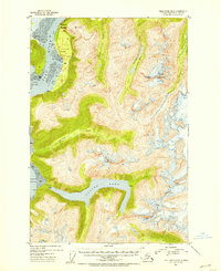
1951 Map of Taku River B-6
USGS Topo · Published 1954About this map
Taku River and the saltwater reaches of Taku Inlet dominate this 1951 topographic study of the Alaska-Canada borderlands. The presence of a Customhouse and Taku Lodge near the river's edge signifies the area's role as a transit corridor into the interior. The landscape is defined by massive ice and water features, from the Hole-in-the-Wall Glacier to the deep waters of Turner Lake. Several Homestead Entry Survey plots, such as Hes No 108 and Hes No 82, reveal early efforts to establish permanent claims within the Tongass National Forest. Inland, the terrain rises sharply toward peaks like Mount Swineford, drained by Davidson Creek and Johnson Creek into the silt-laden flats of the main river valley.
Find a feature on this map
25 named features on this map. Tap any name to fly to it.
Don’t see what you’re looking for? This feature index may not catch every label — zoom into the map to look around manually.
Map Details
Editions of this 1951 Taku River B-6 Map
4 editions found
Other maps of this area

1948 · Juneau B-1
USGS Topo · 1:63,360

1951 · Juneau
USGS Topo · 1:250,000

1951 · Taku River B-6
USGS Topo · 1:63,360

1951 · Taku River A-5
USGS Topo · 1:63,360

1951 · Taku River A-6
USGS Topo · 1:63,360

1951 · Taku River B-5
USGS Topo · 1:63,360

1951 · Juneau A-1
USGS Topo · 1:63,360

1952 · Juneau B-1
USGS Topo · 1:63,360

1953 · Taku River
USGS Topo · 1:250,000

1954 · Juneau A-1
USGS Topo · 1:63,360