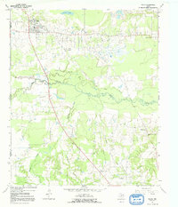
1964 Map of Talco
USGS Topo · Published 1992About this map
The Talco Oil Field dominates the landscape of north-central Titus County, where the industrial presence of oil production is mapped alongside rural homesteads and agricultural terrain. In the town of Talco, the presence of a High Sch and Water Tank indicate a developed local hub, while the nearby Talco Rodeo Ground highlights the cultural significance of ranching traditions in East Texas. The map reveals a complex drainage system led by White Oak Creek and its many tributaries, including Lewis Creek and Ripley Creek. These waterways and the expansive Big Slough define the bottomlands between the higher elevations where settlements like Maple Springs and Bridges Chapel are found. An Old Railroad Grade cutting through the center of the quadrangle serves as a reminder of former transport corridors that once moved resources through these wooded creek basins.
Find a feature on this map
24 named features on this map. Tap any name to fly to it.
Don’t see what you’re looking for? This feature index may not catch every label — zoom into the map to look around manually.
Map Details
Editions of this 1964 Talco Map
2 editions found
Other maps of this area

1953 · Texarkana
USGS Topo · 1:250,000

1956 · Texarkana
USGS Topo · 1:250,000

1964 · Mount Vernon
USGS Topo · 1:24,000

1964 · Cuthand
USGS Topo · 1:24,000

1964 · Wilkinson
USGS Topo · 1:24,000

1964 · Talco
USGS Topo · 1:24,000

1964 · Hagansport
USGS Topo · 1:24,000

1964 · Bogata
USGS Topo · 1:24,000

1965 · Winfield
USGS Topo · 1:24,000

1965 · Mount Pleasant
USGS Topo · 1:24,000