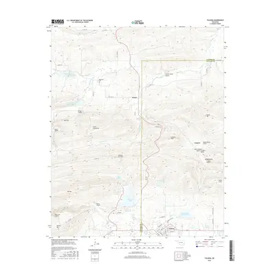
2016 Map of Talihina
USGS Topo · Published 2016About this map
Talihina serves as the primary hub at the southern edge of this landscape, where the street grid transitions into a complex system of mountain hollows and water management sites. The terrain is dominated by significant ridgelines including Winding Stair Mtn and Buffalo Mtn, which frame the deep recesses of Devils Hollow and Bear Den Hollow. To the north, the small settlement of Bengal is situated near Peachland Cr and the Peachland Cem, offering a focused look at rural placement in the foothills. The area's hydrology is remarkably engineered, featuring several numbered reservoirs such as Rock Cr Site 3 Reservoir and Fourche Maline Cr Site 13 Reservoir, alongside the larger Lake Carl Albert. These man-made bodies of water, along with Lake Talihina, illustrate the extensive water resource management integrated into the valley's geography.
Find a feature on this map
62 named features on this map. Tap any name to fly to it.
Don’t see what you’re looking for? This feature index may not catch every label — zoom into the map to look around manually.
Map Details
Editions of this 2016 Talihina Map
This is the sole edition of this map. No revisions or reprints were ever made.
Other maps of this area

1900 · Winding Stair
USGS Topo · 1:125,000

1901 · Tuskahoma
USGS Topo · 1:125,000

1908 · Tuskahoma
USGS Topo · 1:125,000

1909 · Tuskahoma
USGS Topo · 1:125,000

1909 · Winding Stair
USGS Topo · 1:125,000

1940 · Red Oak
USGS Topo · 1:62,500

1943 · Red Oak
USGS Topo · 1:62,500

1950 · Mcalester
USGS Topo · 1:250,000

1962 · McAlester
USGS Topo · 1:250,000

1965 · McAlester
USGS Topo · 1:250,000