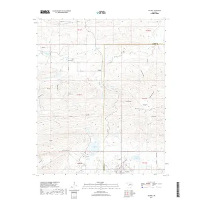
2018 Map of Talihina
USGS Topo · Published 2018About this map
Talihina serves as the primary hub in this portion of southeastern Oklahoma, situated near the intersection of the Latimer Co and Le Flore Co lines. The landscape is defined by the steep rises of Winding Stair Mtn and Buffalo Mtn, which frame the valley floors where the settlements of Bengal and Compton are established. Water management is a central theme of the local geography, with several significant impoundments including Lake Carl Albert, Lake Talihina, and Rock Creek Site 4 Reservoir providing resources to the region. Traces of early settlement and local genealogy are preserved at Peachland Cem, located north of the rugged heights of Granny Graham Mtn. The topography is etched with numerous hollows such as Devils Hollow and Baker Hollow, illustrating a terrain where transportation routes like Railroad St and Rock Creek Rd must navigate a complex network of ridges and creek beds.
Find a feature on this map
68 named features on this map. Tap any name to fly to it.
Don’t see what you’re looking for? This feature index may not catch every label — zoom into the map to look around manually.
Map Details
Editions of this 2018 Talihina Map
This is the sole edition of this map. No revisions or reprints were ever made.
Other maps of this area

1900 · Winding Stair
USGS Topo · 1:125,000

1901 · Tuskahoma
USGS Topo · 1:125,000

1908 · Tuskahoma
USGS Topo · 1:125,000

1909 · Tuskahoma
USGS Topo · 1:125,000

1909 · Winding Stair
USGS Topo · 1:125,000

1940 · Red Oak
USGS Topo · 1:62,500

1943 · Red Oak
USGS Topo · 1:62,500

1950 · Mcalester
USGS Topo · 1:250,000

1962 · McAlester
USGS Topo · 1:250,000

1965 · McAlester
USGS Topo · 1:250,000