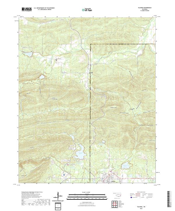
2022 Map of Talihina
USGS Topo · Published 2022About this map
Talihina serves as the gateway to the massive ridges of the Ouachita Mountains in this 2022 topographical study. The town’s grid, featuring Church St and Railroad St, sits at the base of Buffalo Mtn, where the valley floor transitions into steep, timbered heights. The landscape is defined by the east-west spine of Winding Stair Mtn and the isolated peaks of Bear Mtn and Granny Graham Mtn. North of the town center, a series of reservoirs including Lake Carl Albert, Lake Talihina, and Rock Creek Site 4 Reservoir manage the drainage of Rock Creek. Small communities like Bengal and Compton are shown along the northern and eastern slopes, connected by winding mountain roads. Genealogists will find the Peachland Cem located near Peachland Cr, while the rugged southern terrain is marked by descriptive landmarks like Devils Hollow and Bear Den Hollow.
Find a feature on this map
77 named features on this map. Tap any name to fly to it.
Don’t see what you’re looking for? This feature index may not catch every label — zoom into the map to look around manually.
Map Details
Editions of this 2022 Talihina Map
This is the sole edition of this map. No revisions or reprints were ever made.
Other maps of this area

1900 · Winding Stair
USGS Topo · 1:125,000

1901 · Tuskahoma
USGS Topo · 1:125,000

1908 · Tuskahoma
USGS Topo · 1:125,000

1909 · Tuskahoma
USGS Topo · 1:125,000

1909 · Winding Stair
USGS Topo · 1:125,000

1940 · Red Oak
USGS Topo · 1:62,500

1943 · Red Oak
USGS Topo · 1:62,500

1950 · Mcalester
USGS Topo · 1:250,000

1962 · McAlester
USGS Topo · 1:250,000

1965 · McAlester
USGS Topo · 1:250,000