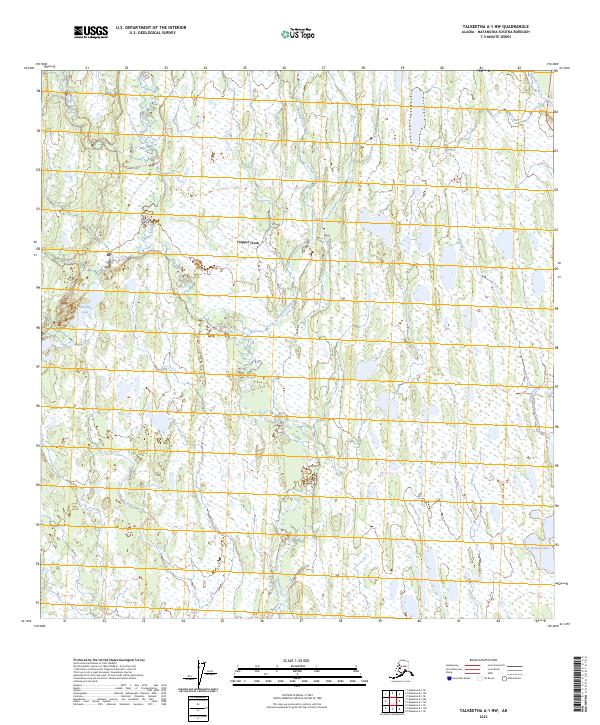
2023 Map of Talkeetna A-1 NW
USGS Topo · Published 2023About this map
Trapper Creek stands as the primary settlement in this water-heavy landscape within the Matanuska-Susitna Borough. The map reveals a complex network of wetlands and small water bodies, defined by the winding paths of Sawmill Creek, Ninemile Creek, and Moose Creek. These waterways, along with the broader Gate Creek system, suggest a lowland terrain where drainage patterns have dictated the sparse human footprint. Oilwell Road provides the principal overland transit route through the western half of the quadrangle, passing near Whistling Lake. The abundance of small, unnamed ponds surrounding Rockys Lakes indicates a glacial or muskeg environment typical of this Alaskan interior region, where seasonal water levels significantly influence land use and access.
Find a feature on this map
14 named features on this map. Tap any name to fly to it.
Don’t see what you’re looking for? This feature index may not catch every label — zoom into the map to look around manually.
Map Details
Editions of this 2023 Talkeetna A-1 NW Map
This is the sole edition of this map. No revisions or reprints were ever made.
Other maps of this area

1950 · Talkeetna
USGS Topo · 1:250,000

1951 · Talkeetna
USGS Topo · 1:250,000

1951 · Talkeetna B-1
USGS Topo · 1:63,360

1952 · Talkeetna A-1
USGS Topo · 1:63,360

1954 · Talkeetna A-2
USGS Topo · 1:63,360

1954 · Talkeetna B-2
USGS Topo · 1:63,360

1958 · Talkeetna B-1
USGS Topo · 1:63,360
1958 · Talkeetna A-1
USGS Topo · 1:63,360

1958 · Talkeetna
USGS Topo · 1:250,000

1965 · Talkeetna
USGS Topo · 1:250,000