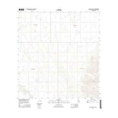
2016 Map of Talkeetna A-3 NW
USGS Topo · Published 2016About this map
Mt Yenlo dominates the southeastern corner of this Alaskan landscape, rising above a network of waterways that define the Matanuska-Susitna region. The drainage patterns of Farmers Cr and Mill Cr reveal the intricate topography of the northern sections, while the southern reaches are characterized by the broader aquatic features of Donkey Cr Lake and the winding Donkey Creek Slough. This 2016 survey illustrates the pristine, undeveloped character of the Matanuska-Susitna Borough, where the terrain is shaped entirely by the movement of water from the heights of the Yenlo hills toward the Yenlo Cr drainage. The absence of roads or established settlements emphasizes the wilderness state of the land at this time, providing a clear record of the area's hydrography before any modern human encroachment or infrastructure changed the natural flow of Donkey Cr.
Find a feature on this map
11 named features on this map. Tap any name to fly to it.
Don’t see what you’re looking for? This feature index may not catch every label — zoom into the map to look around manually.
Map Details
Editions of this 2016 Talkeetna A-3 NW Map
This is the sole edition of this map. No revisions or reprints were ever made.
Other maps of this area

1950 · Talkeetna
USGS Topo · 1:250,000

1951 · Talkeetna
USGS Topo · 1:250,000

1954 · Talkeetna A-3
USGS Topo · 1:63,360

1954 · Talkeetna B-4
USGS Topo · 1:63,360

1954 · Talkeetna A-4
USGS Topo · 1:63,360

1954 · Talkeetna B-3
USGS Topo · 1:63,360

1958 · Talkeetna
USGS Topo · 1:250,000

1965 · Talkeetna
USGS Topo · 1:250,000
2013 · Talkeetna B-3 SE
USGS Topo · 1:25,000
2013 · Talkeetna B-3 SW
USGS Topo · 1:25,000