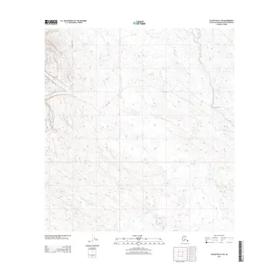
2013 Map of Talkeetna B-3 SW
USGS Topo · Published 2013About this map
Collinsville stands as a focal point in this 2013 survey of the Matanuska-Susitna region, situated among a dense network of high-latitude waterways. The landscape is defined by the drainage patterns of Lake Creek and Sunflower Creek along the eastern edge, with numerous smaller tributaries like Mills Cr and Home Cr cutting through the terrain. A notable logistical feature is the Winter Trl, which provides seasonal access through the interior, reflecting the specialized transportation needs of the Alaskan wilderness where traditional roads are absent. This 1:25,000 scale detail captures the transition of the land as it rises from the creek beds of Twin Cr and Farmers Cr, offering a clear look at the topographic relief and remote hydrography that dictates movement and settlement in this part of the borough.
Find a feature on this map
11 named features on this map. Tap any name to fly to it.
Don’t see what you’re looking for? This feature index may not catch every label — zoom into the map to look around manually.
Map Details
Editions of this 2013 Talkeetna B-3 SW Map
This is the sole edition of this map. No revisions or reprints were ever made.
Other maps of this area

1950 · Talkeetna
USGS Topo · 1:250,000

1951 · Talkeetna
USGS Topo · 1:250,000

1954 · Talkeetna A-3
USGS Topo · 1:63,360

1954 · Talkeetna B-4
USGS Topo · 1:63,360

1954 · Talkeetna A-4
USGS Topo · 1:63,360

1954 · Talkeetna B-3
USGS Topo · 1:63,360

1958 · Talkeetna
USGS Topo · 1:250,000

1965 · Talkeetna
USGS Topo · 1:250,000
2013 · Talkeetna B-3 SE
USGS Topo · 1:25,000
2013 · Talkeetna A-3 NE
USGS Topo · 1:25,000