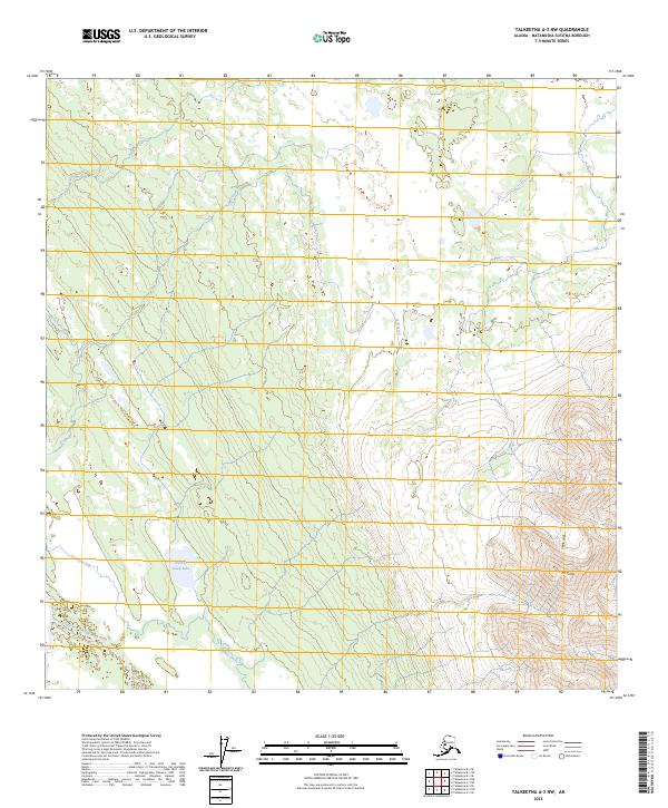
2023 Map of Talkeetna A-3 NW
USGS Topo · Published 2023About this map
Yenlo Hills dominate the southeastern corner of this Alaskan landscape, rising to the summit of Mt Yenlo. This modern topographic study reveals a wilderness defined by its complex drainage systems, where Farmers Creek and Mill Creek cut through the northern townships. The low-lying western reaches are characterized by the interconnected waters of Donkey Creek Lake, feeding into Donkey Creek and the meandering Donkey Creek Slough. This region of the Matanuska-Susitna Borough is presented without roads or established settlements, showing instead the raw hydrography and elevation contours that dictate travel and land use in the Alaskan interior. The map clearly delineates the survey boundaries for T25N R12W and surrounding townships, providing an essential reference for understanding the physical geography of this undeveloped territory.
Find a feature on this map
11 named features on this map. Tap any name to fly to it.
Don’t see what you’re looking for? This feature index may not catch every label — zoom into the map to look around manually.
Map Details
Editions of this 2023 Talkeetna A-3 NW Map
This is the sole edition of this map. No revisions or reprints were ever made.
Other maps of this area

1950 · Talkeetna
USGS Topo · 1:250,000

1951 · Talkeetna
USGS Topo · 1:250,000

1954 · Talkeetna A-3
USGS Topo · 1:63,360

1954 · Talkeetna B-4
USGS Topo · 1:63,360

1954 · Talkeetna A-4
USGS Topo · 1:63,360

1954 · Talkeetna B-3
USGS Topo · 1:63,360

1958 · Talkeetna
USGS Topo · 1:250,000

1965 · Talkeetna
USGS Topo · 1:250,000
2013 · Talkeetna B-3 SE
USGS Topo · 1:25,000
2013 · Talkeetna B-3 SW
USGS Topo · 1:25,000