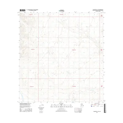
2016 Map of Talkeetna A-3 SE
USGS Topo · Published 2016About this map
The Yentna River flows through the southwestern corner of this Matanuska-Susitna terrain, marking a low-lying riparian corridor amidst a landscape defined by an intricate network of drainage systems. Key tributaries like Yenlo Cr and Fish Lake Cr weave across the township and range lines, illustrating the hydrological patterns of this subarctic region. The presence of Link Lake in the southern reaches, alongside Bottle Cr, highlights the isolated water bodies that characterize this wilderness. This 2016 survey documents the untouched topography within the Public Land Survey System grids, including sections of t23n r10w and t24n r10w, where the absence of roads or permanent settlements emphasizes the remote nature of the Alaskan interior at the start of the 21st century.
Find a feature on this map
14 named features on this map. Tap any name to fly to it.
Don’t see what you’re looking for? This feature index may not catch every label — zoom into the map to look around manually.
Map Details
Editions of this 2016 Talkeetna A-3 SE Map
This is the sole edition of this map. No revisions or reprints were ever made.
Other maps of this area

1949 · Tyonek
USGS Topo · 1:250,000

1950 · Talkeetna
USGS Topo · 1:250,000

1951 · Talkeetna
USGS Topo · 1:250,000

1951 · Tyonek
USGS Topo · 1:250,000

1954 · Tyonek D-3
USGS Topo · 1:63,360

1954 · Talkeetna A-3
USGS Topo · 1:63,360

1954 · Tyonek D-4
USGS Topo · 1:63,360

1954 · Talkeetna A-2
USGS Topo · 1:63,360

1958 · Tyonek
USGS Topo · 1:250,000

1958 · Talkeetna
USGS Topo · 1:250,000