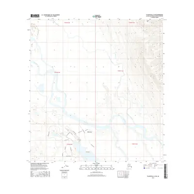
2016 Map of Talkeetna A-3 SW
USGS Topo · Published 2016About this map
Skwentna and the nearby settlement of Sdak'dal'iy sit at the center of this remote landscape where the braided channels of the Yentna River meet a complex network of residential streets. This 2016 survey highlights a unique layout of roads with nautical and arboreal names, such as Dungeness Way, Irish Lord Drive, and Alderwood Drive, which suggest a planned community or recreational development set against the wilderness. To the north and east, the terrain rises into the Yenlo Hills, while the lowlands are dominated by the shifting hydrology of Donkey Cr and the Donkey Creek Slough. The map documents the persistent human presence in this riverine environment, where aviation and water travel often supersede traditional highway access, as evidenced by the dense cluster of named lanes like Hellwig Avenue and Pinewood Avenue isolated from the broader state road network.
Find a feature on this map
26 named features on this map. Tap any name to fly to it.
Don’t see what you’re looking for? This feature index may not catch every label — zoom into the map to look around manually.
Map Details
Editions of this 2016 Talkeetna A-3 SW Map
This is the sole edition of this map. No revisions or reprints were ever made.
Other maps of this area

1949 · Tyonek
USGS Topo · 1:250,000

1950 · Talkeetna
USGS Topo · 1:250,000

1951 · Talkeetna
USGS Topo · 1:250,000

1951 · Tyonek
USGS Topo · 1:250,000

1954 · Talkeetna A-3
USGS Topo · 1:63,360

1954 · Tyonek D-5
USGS Topo · 1:63,360

1954 · Tyonek D-4
USGS Topo · 1:63,360

1954 · Talkeetna A-4
USGS Topo · 1:63,360

1958 · Tyonek
USGS Topo · 1:250,000

1958 · Talkeetna
USGS Topo · 1:250,000