
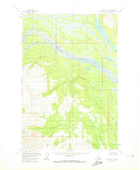
1954 Map of Tyonek D-5
USGS Topo · Published 1961About this map
The Skwentna River and Hayes River converge in this mid-century Alaskan interior landscape, carving through a glaciated terrain defined by drainage systems and upland ridges. The braided river channels dominate the central valley, a characteristic pattern of high-sediment glacial runoff. In the northeastern corner, Shell Lake sits at the foot of the Shell Hills, serving as a significant topographical landmark in an area otherwise characterized by unnamed peaks and dense contour intervals.
Find a feature on this map
11 named features on this map. Tap any name to fly to it.
Don’t see what you’re looking for? This feature index may not catch every label — zoom into the map to look around manually.
Map Details
Editions of this 1954 Tyonek D-5 Map
2 editions found
Other maps of this area

1949 · Tyonek
USGS Topo · 1:250,000

1950 · Talkeetna
USGS Topo · 1:250,000

1951 · Talkeetna
USGS Topo · 1:250,000

1951 · Tyonek
USGS Topo · 1:250,000

1954 · Talkeetna A-3
USGS Topo · 1:63,360

1954 · Tyonek C-5
USGS Topo · 1:63,360

1954 · Tyonek C-4
USGS Topo · 1:63,360

1954 · Tyonek D-4
USGS Topo · 1:63,360

1954 · Talkeetna A-4
USGS Topo · 1:63,360

1958 · Tyonek C-6
USGS Topo · 1:63,360