
1958 Map of Tyonek C-6
USGS Topo · Published 1961About this map
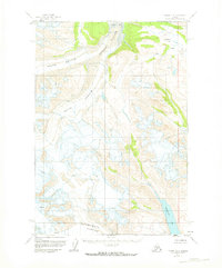
Trimble Glacier dominates this high-altitude landscape, its massive ice flow fed by a North Branch and South Branch that carve through the surrounding peaks. In the late 1950s, the area remained a wilderness of ice and water, where the Trimble River emerged from the glacial terminus to flow northward. To the east, Hayes River and its tributary Coal Creek provide a distinct drainage system separated by the Hayes River Pass. The map serves as a primary record of glacial extent and alpine hydrology before modern climate shifts, particularly notable for the southern reach of the Triumvirate Glacier and the cold depths of Strandline Lake at the foot of the mountains. This 1958 survey captures the intricate patterns of crevasses and ice fields that defined travel and geography in this part of Alaska during the mid-century.
Find a feature on this map
10 named features on this map. Tap any name to fly to it.
Don’t see what you’re looking for? This feature index may not catch every label — zoom into the map to look around manually.
Map Details
Editions of this 1958 Tyonek C-6 Map
2 editions found
Other maps of this area

1949 · Tyonek
USGS Topo · 1:250,000

1951 · Tyonek
USGS Topo · 1:250,000

1954 · Tyonek C-5
USGS Topo · 1:63,360

1954 · Tyonek D-5
USGS Topo · 1:63,360

1958 · Tyonek B-5
USGS Topo · 1:63,360

1958 · Tyonek B-6
USGS Topo · 1:63,360

1958 · Tyonek D-6
USGS Topo · 1:63,360

1958 · Tyonek
USGS Topo · 1:250,000
1958 · Tyonek B-7
USGS Topo · 1:63,360
1958 · Tyonek D-7
USGS Topo · 1:63,360