
1958 Map of Tyonek B-6
USGS Topo · Published 1961About this map
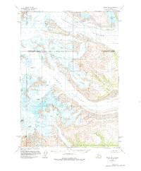
Mount Spurr dominates this remote Alaskan landscape, anchoring a massive glacial network in the late 1950s. The survey reveals a dynamic frozen environment where the Triumvirate Glacier and Capps Glacier carve through the high terrain, marked by extensive crevasses that signify active movement. To the southeast, Crater Peak stands as a significant volcanic feature, with the map explicitly noting deposits of Volcanic Ash nearby, indicating recent geological activity. The presence of Strandline Lake at the edge of the ice field provides a clear point of reference for the shifting boundaries between ice, water, and rock. Unlike more settled regions, this map serves as a study in pure wilderness and the raw forces of glaciation and volcanism, recording the precise state of the Dogshead Glacier before later decades of environmental change.
Find a feature on this map
8 named features on this map. Tap any name to fly to it.
Don’t see what you’re looking for? This feature index may not catch every label — zoom into the map to look around manually.
Map Details
Editions of this 1958 Tyonek B-6 Map
2 editions found
Other maps of this area

1949 · Tyonek
USGS Topo · 1:250,000

1951 · Tyonek
USGS Topo · 1:250,000

1954 · Tyonek C-5
USGS Topo · 1:63,360

1958 · Tyonek A-6
USGS Topo · 1:63,360

1958 · Tyonek A-5
USGS Topo · 1:63,360

1958 · Tyonek C-6
USGS Topo · 1:63,360

1958 · Tyonek B-5
USGS Topo · 1:63,360

1958 · Tyonek
USGS Topo · 1:250,000
1958 · Tyonek B-7
USGS Topo · 1:63,360
1958 · Tyonek A-7
USGS Topo · 1:63,360