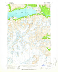
1958 Map of Tyonek A-7
USGS Topo · Published 1966About this map
Chakachamna Lake dominates the northern reaches of this glacial terrain, serving as the source for the Chakachatna River flowing to the east. This late 1950s survey, based on aerial photography from 1954 and 1957, reveals a complex landscape of ice and meltwater drainage on the Kenai Peninsula. The massive Mc Arthur Glacier and Blockade Glacier carve deep valleys through the mountains, feeding the braided channels of the Mc Arthur River as it winds toward the coast. Other notable glacial features include the Barrier Glacier and the Nagish Lamina R, which empties into the northern shore of the lake. The map reflects a moment in time when this region remained largely unsurveyed on the ground, with land lines predetermined by the Bureau of Land Management rather than through physical markers.
Find a feature on this map
7 named features on this map. Tap any name to fly to it.
Don’t see what you’re looking for? This feature index may not catch every label — zoom into the map to look around manually.
Map Details
Editions of this 1958 Tyonek A-7 Map
2 editions found
Other maps of this area

1944 · Kenai
USGS Topo · 1:250,000

1949 · Tyonek
USGS Topo · 1:250,000

1950 · Kenai
USGS Topo · 1:250,000

1951 · Tyonek
USGS Topo · 1:250,000

1958 · Tyonek A-6
USGS Topo · 1:63,360

1958 · Tyonek B-6
USGS Topo · 1:63,360

1958 · Tyonek B-8
USGS Topo · 1:63,360

1958 · Kenai D-8
USGS Topo · 1:63,360

1958 · Kenai D-6
USGS Topo · 1:63,360

1958 · Kenai D-7
USGS Topo · 1:63,360