
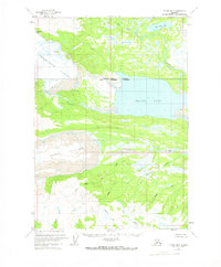
1958 Map of Tyonek B-5
USGS Topo · Published 1961About this map
Triumvirate Glacier and Capps Glacier dominate the western edge of this 1958 survey, showing their massive icy reach across the Kenai Peninsula before modern glacial retreat. These frozen expanses are marked by deep crevasses, feeding the hydrological systems that define the surrounding drainage. To the east, the sprawling Beluga Lake serves as a central landmark, receiving the flow of the Chichantna River through its southern marshes. The northern portion of the quadrangle is defined by the Coal Creek watershed, including Coal Creek Lake, illustrating a remote landscape of wetlands and complex waterways. This survey was developed from aerial photography taken in the early 1950s, capturing the area's geography at a time when no roads or trails reached into this wilderness.
Find a feature on this map
7 named features on this map. Tap any name to fly to it.
Don’t see what you’re looking for? This feature index may not catch every label — zoom into the map to look around manually.
Map Details
Editions of this 1958 Tyonek B-5 Map
2 editions found
Other maps of this area

1949 · Tyonek
USGS Topo · 1:250,000

1951 · Tyonek
USGS Topo · 1:250,000

1954 · Tyonek C-5
USGS Topo · 1:63,360

1954 · Tyonek C-4
USGS Topo · 1:63,360

1954 · Tyonek B-4
USGS Topo · 1:63,360

1958 · Tyonek A-6
USGS Topo · 1:63,360

1958 · Tyonek A-5
USGS Topo · 1:63,360

1958 · Tyonek A-4
USGS Topo · 1:63,360

1958 · Tyonek C-6
USGS Topo · 1:63,360

1958 · Tyonek B-6
USGS Topo · 1:63,360