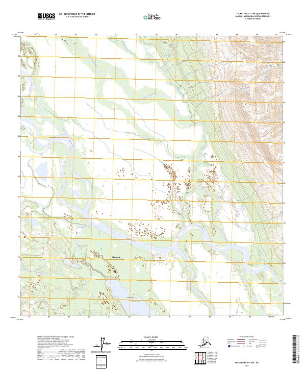
2023 Map of Talkeetna A-3 SW
USGS Topo · Published 2023About this map
Skwentna sits at a critical junction of glacial waters and marshlands in this modern topographic survey of the Matanuska-Susitna region. The landscape is defined by the braided path of the Yentna River, which dominates the central valley with its complex network of active channels and side sloughs. To the north, the Donkey Creek Slough and Donkey Creek drain the lowlands, while the eastern edge of the map begins its ascent into the Yentna Hills.
Find a feature on this map
13 named features on this map. Tap any name to fly to it.
Don’t see what you’re looking for? This feature index may not catch every label — zoom into the map to look around manually.
Map Details
Editions of this 2023 Talkeetna A-3 SW Map
This is the sole edition of this map. No revisions or reprints were ever made.
Other maps of this area

1949 · Tyonek
USGS Topo · 1:250,000

1950 · Talkeetna
USGS Topo · 1:250,000

1951 · Talkeetna
USGS Topo · 1:250,000

1951 · Tyonek
USGS Topo · 1:250,000

1954 · Talkeetna A-3
USGS Topo · 1:63,360

1954 · Tyonek D-5
USGS Topo · 1:63,360

1954 · Tyonek D-4
USGS Topo · 1:63,360

1954 · Talkeetna A-4
USGS Topo · 1:63,360

1958 · Tyonek
USGS Topo · 1:250,000

1958 · Talkeetna
USGS Topo · 1:250,000