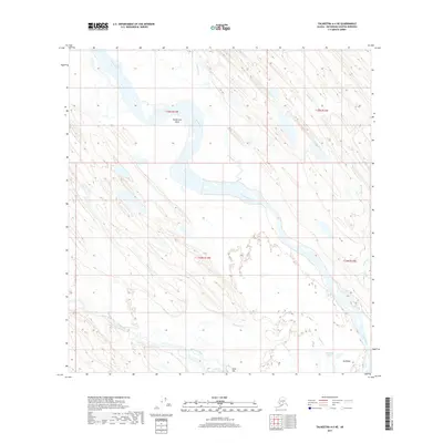
2017 Map of Talkeetna A-4 NE
USGS Topo · Published 2017About this map
The Yentna River winds through this section of the Matanuska-Susitna Borough, defining a complex landscape of alluvial bars and shifting channels. Notable for the prominent Youngstown Bend, the river system is fed by numerous tributaries including Clearwater Cr and Donkey Cr, which drain the surrounding lowlands. To the south, the Kichatna River joins the drainage network near the distinctive rise of Gold Hill. This 2017 survey captures the wilderness character of the region, where native place names like Dusdilda Betnu and Dusdilda persist alongside later geographic designations. The absence of modern infrastructure emphasizes the remote, water-dominated environment of the Susitna Valley basin, where braided streams and seasonal drainage patterns like Gagnan Cr dictate the local geography.
Find a feature on this map
14 named features on this map. Tap any name to fly to it.
Don’t see what you’re looking for? This feature index may not catch every label — zoom into the map to look around manually.
Map Details
Editions of this 2017 Talkeetna A-4 NE Map
This is the sole edition of this map. No revisions or reprints were ever made.
Other maps of this area

1950 · Talkeetna
USGS Topo · 1:250,000

1951 · Talkeetna
USGS Topo · 1:250,000

1954 · Talkeetna A-3
USGS Topo · 1:63,360

1954 · Talkeetna B-4
USGS Topo · 1:63,360

1954 · Talkeetna A-4
USGS Topo · 1:63,360

1954 · Talkeetna B-3
USGS Topo · 1:63,360

1958 · Talkeetna
USGS Topo · 1:250,000

1965 · Talkeetna
USGS Topo · 1:250,000
2013 · Talkeetna B-3 SW
USGS Topo · 1:25,000
2016 · Talkeetna A-3 NW
USGS Topo · 1:25,000