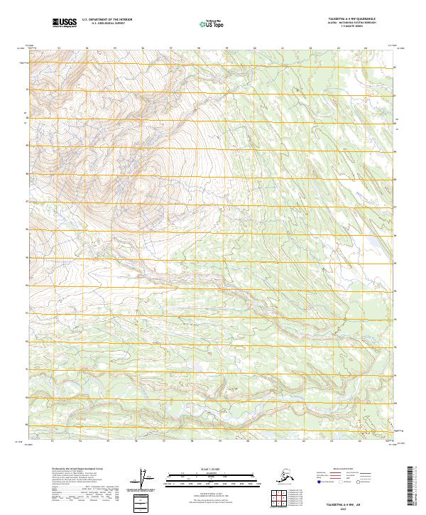
2023 Map of Talkeetna A-4 NW
USGS Topo · Published 2023About this map
The Nakochana River winds through the central portion of this remote Matanuska-Susitna landscape, demonstrating the complex drainage patterns of the Alaskan interior. This modern 2023 survey by the U.S. Geological Survey captures the hydrologic relationship between the Kichatna River and its northern tributaries before they reach larger valley systems. The elevation is defined by Nin Ridge, which runs through the center of the sheet, separating the southern river flats from the higher ground and smaller drainage systems like Gagnan Creek in the northeast. The lack of roads or established settlements on this sheet highlights the wilderness character of the Talkeetna region, where topographic details are primarily limited to natural watercourses and significant glacial-carved terrain features. Researchers can use this data to study current water flow and changes in the river morphology within the Matanuska-Susitna Borough.
Find a feature on this map
9 named features on this map. Tap any name to fly to it.
Don’t see what you’re looking for? This feature index may not catch every label — zoom into the map to look around manually.
Map Details
Editions of this 2023 Talkeetna A-4 NW Map
This is the sole edition of this map. No revisions or reprints were ever made.
Other maps of this area

1950 · Talkeetna
USGS Topo · 1:250,000

1951 · Talkeetna
USGS Topo · 1:250,000

1954 · Talkeetna B-4
USGS Topo · 1:63,360

1954 · Talkeetna A-4
USGS Topo · 1:63,360

1958 · Talkeetna A-5
USGS Topo · 1:63,360

1958 · Talkeetna B-5
USGS Topo · 1:63,360

1958 · Talkeetna
USGS Topo · 1:250,000

1965 · Talkeetna
USGS Topo · 1:250,000
2017 · Talkeetna B-4 SW
USGS Topo · 1:25,000
2017 · Talkeetna B-4 SE
USGS Topo · 1:25,000