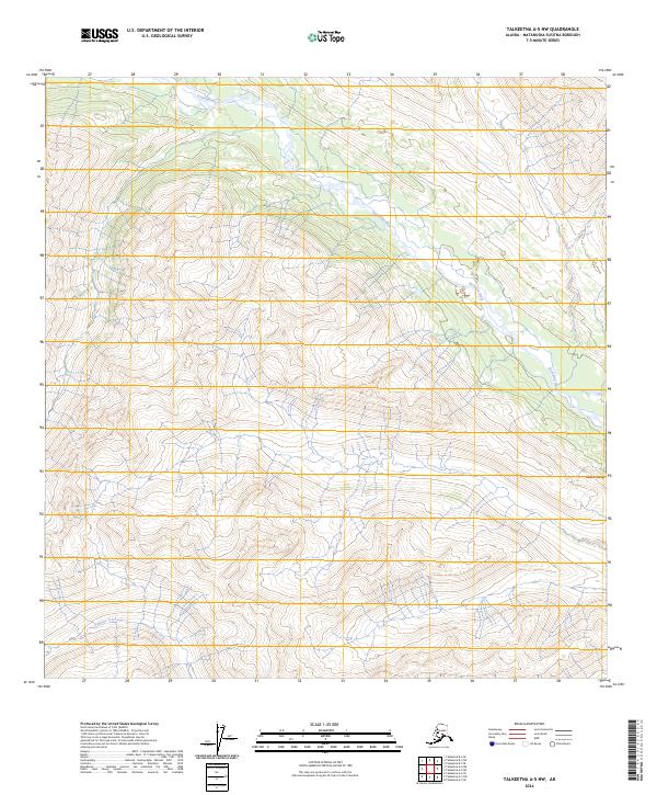
2024 Map of Talkeetna A-5 NW
USGS Topo · Published 2024About this map
High peaks of the Alaska Range dominate this remote interior landscape where glacial meltwaters feed significant drainage systems. The Kichatna River snakes through the northern and eastern portions of the terrain, carving a path through dramatic elevation changes that characterize the region. Further south, Johnson Creek flows through the lower elevations, establishing a distinct drainage pattern separate from the main river valley. This 2024 survey detail illustrates the raw topographical structure of the Matanuska-Susitna Borough, highlighting the land's natural divisions defined by the Public Land Survey System, including t24n r17w and t25n r16w. The lack of road infrastructure or named settlements underscores the wilderness character of these high-altitude ranges.
Find a feature on this map
8 named features on this map. Tap any name to fly to it.
Don’t see what you’re looking for? This feature index may not catch every label — zoom into the map to look around manually.
Map Details
Editions of this 2024 Talkeetna A-5 NW Map
This is the sole edition of this map. No revisions or reprints were ever made.
Other maps of this area

1950 · Talkeetna
USGS Topo · 1:250,000

1951 · Talkeetna
USGS Topo · 1:250,000

1958 · Talkeetna A-6
USGS Topo · 1:63,360

1958 · Talkeetna A-5
USGS Topo · 1:63,360

1958 · Talkeetna B-5
USGS Topo · 1:63,360

1958 · Talkeetna B-6
USGS Topo · 1:63,360

1958 · Talkeetna
USGS Topo · 1:250,000

1965 · Talkeetna
USGS Topo · 1:250,000
2017 · Talkeetna A-5 SE
USGS Topo · 1:25,000
2017 · Talkeetna A-6 SE
USGS Topo · 1:25,000