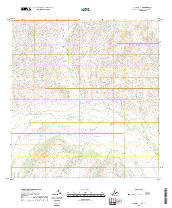
2024 Map of Talkeetna A-6 NW
USGS Topo · Published 2024About this map
Kohlsaat Peak and the surrounding high country define this portion of the Alaska interior within the Matanuska-Susitna Borough. The drainage network is particularly prominent, centered on the Happy River as it moves through Ptarmigan Valley. Significant tributaries and local water bodies including Halfway Lake, Threemile Creek, and Pass Creek illustrate the complex hydrology of this subarctic landscape. The map also traces the origins of the Indian Creek system, showing the West Fork Indian Creek, East Fork Indian Creek, and the main stem of Indian Creek. These features reflect the wilderness character of the region, where the terrain is shaped entirely by natural glacial and fluvial processes without the presence of named roads or established settlements.
Find a feature on this map
13 named features on this map. Tap any name to fly to it.
Don’t see what you’re looking for? This feature index may not catch every label — zoom into the map to look around manually.
Map Details
Editions of this 2024 Talkeetna A-6 NW Map
This is the sole edition of this map. No revisions or reprints were ever made.
Other maps of this area

1949 · McGrath
USGS Topo · 1:250,000

1950 · McGrath
USGS Topo · 1:250,000

1950 · Talkeetna
USGS Topo · 1:250,000

1951 · Talkeetna
USGS Topo · 1:250,000

1958 · Talkeetna A-6
USGS Topo · 1:63,360

1958 · Talkeetna B-6
USGS Topo · 1:63,360

1958 · McGrath B-1
USGS Topo · 1:63,360

1958 · McGrath A-1
USGS Topo · 1:63,360

1958 · Talkeetna
USGS Topo · 1:250,000

1958 · McGrath
USGS Topo · 1:250,000