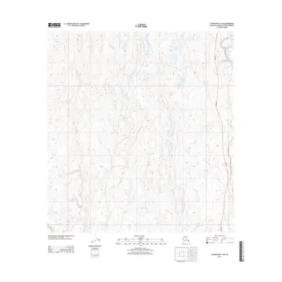
2013 Map of Talkeetna B-1 NW
USGS Topo · Published 2013About this map
Lake Denali and Cygnet Lake occupy the northern reaches of this interior Alaskan landscape, which is defined by the complex hydrography of the Trapper Cr and Moose Cr drainages. The Parks Hwy provides a singular corridor of terrestrial access along the eastern margin, paralleling the wide glacial course of the Chulitna River. The 2013 survey illustrates the characteristic terrain of the Matanuska-Susitna region, showing a transition between low-lying wetland complexes and higher ground. While largely devoid of dense settlements, the map records the essential infrastructure of the modern Alaskan wilderness, where the highway and major river systems serve as the primary lifelines through the muskeg and forest.
Find a feature on this map
10 named features on this map. Tap any name to fly to it.
Don’t see what you’re looking for? This feature index may not catch every label — zoom into the map to look around manually.
Map Details
Editions of this 2013 Talkeetna B-1 NW Map
This is the sole edition of this map. No revisions or reprints were ever made.
Other maps of this area

1950 · Talkeetna
USGS Topo · 1:250,000

1951 · Talkeetna
USGS Topo · 1:250,000

1951 · Talkeetna B-1
USGS Topo · 1:63,360

1951 · Talkeetna C-1
USGS Topo · 1:63,360

1954 · Talkeetna B-2
USGS Topo · 1:63,360

1958 · Talkeetna B-1
USGS Topo · 1:63,360

1958 · Talkeetna C-1
USGS Topo · 1:63,360

1958 · Talkeetna C-2
USGS Topo · 1:63,360

1958 · Talkeetna
USGS Topo · 1:250,000

1965 · Talkeetna
USGS Topo · 1:250,000