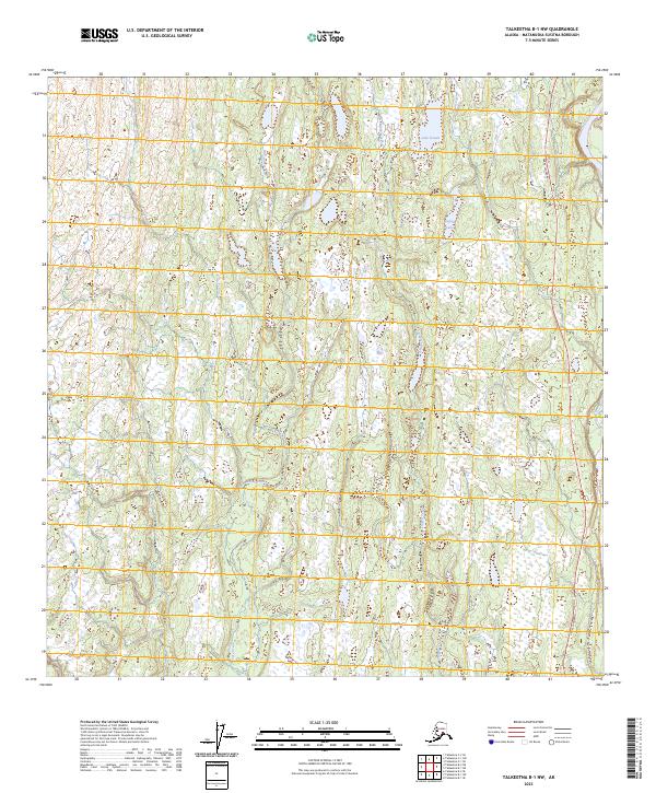
2023 Map of Talkeetna B-1 NW
USGS Topo · Published 2023About this map
Lake Denali and Cygnet Lake occupy the marshy interior of this Southcentral Alaska landscape, situated within the Matanuska-Susitna Borough. The terrain is defined by a dense network of wetlands and small ponds, characteristic of the glacial outwash plains in this region. Drainage is primarily managed by the southward-flowing Moose Creek and Trapper Creek, which meander through a complex mosaic of low-lying brush and water. On the eastern edge of the sheet, the Parks Highway provides the primary corridor for movement, skirting the edges of the broader river valleys. This map illustrates the intersection of vital transit infrastructure with the persistent, water-heavy wilderness that dominates the area north of the Susitna River.
Find a feature on this map
13 named features on this map. Tap any name to fly to it.
Don’t see what you’re looking for? This feature index may not catch every label — zoom into the map to look around manually.
Map Details
Editions of this 2023 Talkeetna B-1 NW Map
This is the sole edition of this map. No revisions or reprints were ever made.
Other maps of this area

1950 · Talkeetna
USGS Topo · 1:250,000

1951 · Talkeetna
USGS Topo · 1:250,000

1951 · Talkeetna B-1
USGS Topo · 1:63,360

1951 · Talkeetna C-1
USGS Topo · 1:63,360

1954 · Talkeetna B-2
USGS Topo · 1:63,360

1958 · Talkeetna B-1
USGS Topo · 1:63,360

1958 · Talkeetna C-1
USGS Topo · 1:63,360

1958 · Talkeetna C-2
USGS Topo · 1:63,360

1958 · Talkeetna
USGS Topo · 1:250,000

1965 · Talkeetna
USGS Topo · 1:250,000