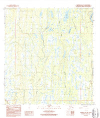
1987 Map of Talkeetna B-1 NW
USGS Topo · Published 1987About this map
Lake Denali and Cygnet Lake sit within a landscape defined by intricate wetland systems and glacial drainage patterns in the Matanuska-Susitna Borough. This 1980s-era topographical study reveals the braiding of the Chulitna R along the eastern margin, contrasted with the meandering courses of Moose Creek and Trapper Creek to the west. While much of the terrain is dominated by water and shifting marshlands, the map documents early human imprints, including a localized Gravel Pit and an established Trail threading through the lower elevations. These features suggest a period of resource extraction and transit development during the late twentieth century, providing a baseline for understanding the region’s topography before contemporary changes in the Alaskan interior.
Find a feature on this map
11 named features on this map. Tap any name to fly to it.
Don’t see what you’re looking for? This feature index may not catch every label — zoom into the map to look around manually.
Map Details
Editions of this 1987 Talkeetna B-1 NW Map
This is the sole edition of this map. No revisions or reprints were ever made.
Other maps of this area

1950 · Talkeetna
USGS Topo · 1:250,000

1951 · Talkeetna
USGS Topo · 1:250,000

1951 · Talkeetna B-1
USGS Topo · 1:63,360

1951 · Talkeetna C-1
USGS Topo · 1:63,360

1954 · Talkeetna B-2
USGS Topo · 1:63,360

1958 · Talkeetna B-1
USGS Topo · 1:63,360

1958 · Talkeetna C-1
USGS Topo · 1:63,360

1958 · Talkeetna C-2
USGS Topo · 1:63,360

1958 · Talkeetna
USGS Topo · 1:250,000

1965 · Talkeetna
USGS Topo · 1:250,000