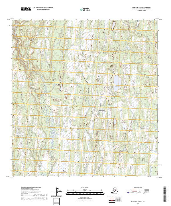
2023 Map of Talkeetna B-1 SW
USGS Topo · Published 2023About this map
The settlement of Trapper Creek serves as a central hub in this modern survey of the Susitna Valley, where a network of local roads and trails radiates into a complex landscape of wetlands and small water bodies. The intersection of the north-south Parks Highway and the westward-reaching Petersville Road defines the local transportation corridor, linking the community to more remote backcountry areas. To the south of the main settlement, the Rangeview Airstrip sits near a dense cluster of residential roads including Rangeview Drive and Jirasek Drive.
Find a feature on this map
26 named features on this map. Tap any name to fly to it.
Don’t see what you’re looking for? This feature index may not catch every label — zoom into the map to look around manually.
Map Details
Editions of this 2023 Talkeetna B-1 SW Map
This is the sole edition of this map. No revisions or reprints were ever made.
Other maps of this area

1950 · Talkeetna
USGS Topo · 1:250,000

1951 · Talkeetna
USGS Topo · 1:250,000

1951 · Talkeetna B-1
USGS Topo · 1:63,360

1952 · Talkeetna A-1
USGS Topo · 1:63,360

1954 · Talkeetna A-2
USGS Topo · 1:63,360

1954 · Talkeetna B-2
USGS Topo · 1:63,360

1958 · Talkeetna B-1
USGS Topo · 1:63,360
1958 · Talkeetna A-1
USGS Topo · 1:63,360

1958 · Talkeetna
USGS Topo · 1:250,000

1965 · Talkeetna
USGS Topo · 1:250,000