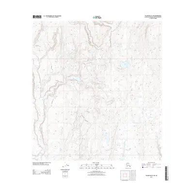
2013 Map of Talkeetna B-2 NE
USGS Topo · Published 2013About this map
Petersville Rd anchors the western corridor of this interior landscape in the Matanuska-Susitna region, providing access to a complex network of glacial lakes and stream systems. The terrain is defined by its water, from the broad Twentyfive Mile Lake in the north to the smaller Safari Lake and Kroto Lake further south. These basins feed into a web of drainages including Kroto Cr, Deep Cr, and Peters Creek. In the southern portion of the quadrangle, a small residential or recreational cluster is evident along W Riggs Loop, W Kandie Rd, and W Gonitzke Rd. This pattern of sparse, targeted road development amid the extensive tributaries of Seventeenmile Creek and the W Fork Moose Cr illustrates the typical contemporary Alaskan approach to seasonal or rural settlement in the bush.
Find a feature on this map
20 named features on this map. Tap any name to fly to it.
Don’t see what you’re looking for? This feature index may not catch every label — zoom into the map to look around manually.
Map Details
Editions of this 2013 Talkeetna B-2 NE Map
This is the sole edition of this map. No revisions or reprints were ever made.
Other maps of this area

1950 · Talkeetna
USGS Topo · 1:250,000

1951 · Talkeetna
USGS Topo · 1:250,000

1951 · Talkeetna B-1
USGS Topo · 1:63,360

1951 · Talkeetna C-1
USGS Topo · 1:63,360

1954 · Talkeetna B-2
USGS Topo · 1:63,360

1958 · Talkeetna B-1
USGS Topo · 1:63,360

1958 · Talkeetna C-1
USGS Topo · 1:63,360

1958 · Talkeetna C-2
USGS Topo · 1:63,360

1958 · Talkeetna
USGS Topo · 1:250,000

1965 · Talkeetna
USGS Topo · 1:250,000