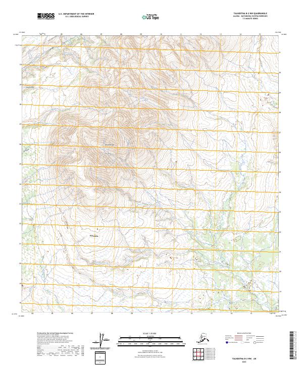
2023 Map of Talkeetna B-2 NW
USGS Topo · Published 2023About this map
Petersville serves as the focal point of human settlement in this landscape, situated south of the high-elevation reaches of the Peters Hills. This area within the Alaska Range is defined by a dense network of watercourses and gulches that drain the surrounding uplands. Access is primary along the Petersville Road, which connects the southern flats to the northern mining and recreation routes like Cache Creek Road and Lucky Creek Drive. To the north, the terrain rises sharply toward peaks drained by Trout Creek and Grant Creek, while the southern reaches are dominated by low-lying wetlands and meandering channels of Black Creek and Martin Creek. The map documents the persistent infrastructure of this mining-heavy region, showing how contemporary road networks follow the same drainages that have drawn prospectors for generations.
Find a feature on this map
33 named features on this map. Tap any name to fly to it.
Don’t see what you’re looking for? This feature index may not catch every label — zoom into the map to look around manually.
Map Details
Editions of this 2023 Talkeetna B-2 NW Map
This is the sole edition of this map. No revisions or reprints were ever made.
Other maps of this area

1950 · Talkeetna
USGS Topo · 1:250,000

1951 · Talkeetna
USGS Topo · 1:250,000

1954 · Talkeetna B-3
USGS Topo · 1:63,360

1954 · Talkeetna B-2
USGS Topo · 1:63,360

1958 · Talkeetna C-2
USGS Topo · 1:63,360

1958 · Talkeetna C-3
USGS Topo · 1:63,360

1958 · Talkeetna
USGS Topo · 1:250,000

1965 · Talkeetna
USGS Topo · 1:250,000
1994 · Talkeetna B-2
USGS Topo · 1:63,360
2013 · Talkeetna B-2 NE
USGS Topo · 1:25,000