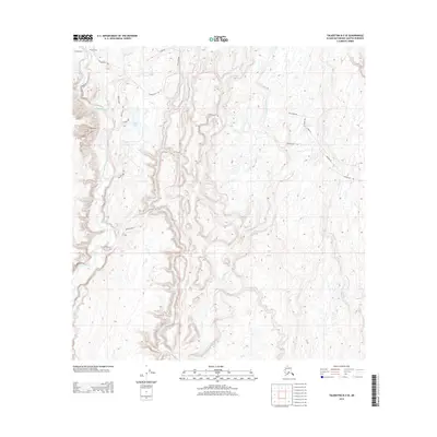
2013 Map of Talkeetna B-2 SE
USGS Topo · Published 2013About this map
Petersville Rd cuts across a landscape defined by an intricate network of waterways and early 21st-century access routes. The drainage patterns of Peters Creek and Kroto Cr illustrate the complex hydrography of the Matanuska-Susitna region, where multiple seasonal and permanent streams like Twentymile Cr and Seventeenmile Cr weave through the terrain. Evidence of localized settlement and recreational access is visible through named loops and circles, such as Bonita Loop and Dyer Cir, which branch off the primary thoroughfares. The inclusion of the Winter Trl and Shulin Lake Trl highlights the area's reliance on specialized transportation corridors suited for the interior's varying seasonal conditions. Smaller landmarks like Jake Lake and specialized routes such as Gate Creek Rd provide specific points of interest for understanding the distribution of properties and public lands during this era.
Find a feature on this map
21 named features on this map. Tap any name to fly to it.
Don’t see what you’re looking for? This feature index may not catch every label — zoom into the map to look around manually.
Map Details
Editions of this 2013 Talkeetna B-2 SE Map
This is the sole edition of this map. No revisions or reprints were ever made.
Other maps of this area

1950 · Talkeetna
USGS Topo · 1:250,000

1951 · Talkeetna
USGS Topo · 1:250,000

1951 · Talkeetna B-1
USGS Topo · 1:63,360

1952 · Talkeetna A-1
USGS Topo · 1:63,360

1954 · Talkeetna A-2
USGS Topo · 1:63,360

1954 · Talkeetna B-2
USGS Topo · 1:63,360

1958 · Talkeetna B-1
USGS Topo · 1:63,360
1958 · Talkeetna A-1
USGS Topo · 1:63,360

1958 · Talkeetna
USGS Topo · 1:250,000

1965 · Talkeetna
USGS Topo · 1:250,000