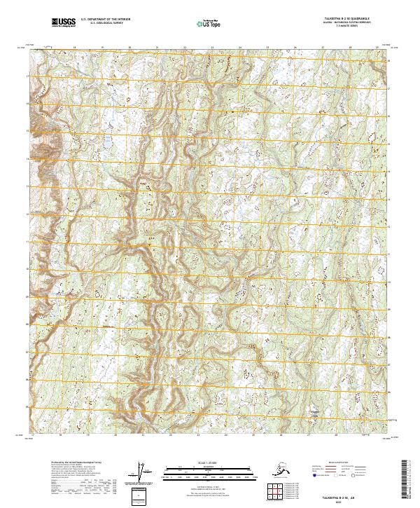
2023 Map of Talkeetna B-2 SE
USGS Topo · Published 2023About this map
Petersville serves as the primary landmark in this interior Alaskan landscape, which is defined by a dense network of braided waterways and low-lying wetlands. The area is intersected by significant transportation corridors such as Petersville Road and several overland routes including the Collinsville Trail and Shulin Lake Trail. These paths provide access through a terrain heavily influenced by the drainage patterns of Peters Creek, Twentymile Creek, and Kroto Creek. In the southeastern corner, the settlement of Trappers Creek marks a point of human activity near the convergence of local streams. The mapping reveals a transition between established roads and more remote 4WD tracks like Garun Loop, reflecting the ongoing balance between accessibility and the wild character of the Matanuska-Susitna region.
Find a feature on this map
16 named features on this map. Tap any name to fly to it.
Don’t see what you’re looking for? This feature index may not catch every label — zoom into the map to look around manually.
Map Details
Editions of this 2023 Talkeetna B-2 SE Map
This is the sole edition of this map. No revisions or reprints were ever made.
Other maps of this area

1950 · Talkeetna
USGS Topo · 1:250,000

1951 · Talkeetna
USGS Topo · 1:250,000

1951 · Talkeetna B-1
USGS Topo · 1:63,360

1952 · Talkeetna A-1
USGS Topo · 1:63,360

1954 · Talkeetna A-2
USGS Topo · 1:63,360

1954 · Talkeetna B-2
USGS Topo · 1:63,360

1958 · Talkeetna B-1
USGS Topo · 1:63,360
1958 · Talkeetna A-1
USGS Topo · 1:63,360

1958 · Talkeetna
USGS Topo · 1:250,000

1965 · Talkeetna
USGS Topo · 1:250,000