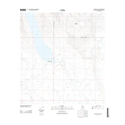
2014 Map of Talkeetna B-3 NW
USGS Topo · Published 2014About this map
Chelatna Lake and its surrounding wilderness define this high-latitude landscape in the Matanuska-Susitna Borough. The sheet captures a significant portion of Denali National Park, where the high alpine terrain gives way to the Kahiltna Glacier in the northeast. The presence of Chelatna Lodge on the southern shore of the lake marks a rare point of habitation in a region otherwise characterized by a dense network of watercourses and seasonal routes. Navigational corridors like the Winter Trl suggest the importance of winter access across this terrain. The drainage systems are extensive, with Lake Cr, Sunflower Cr, and Treasure Cr carving through the slopes. This survey provides a precise record of the hydrological and topographic features before the ongoing shifts in glacial ice and permafrost alter the remote interior.
Find a feature on this map
14 named features on this map. Tap any name to fly to it.
Don’t see what you’re looking for? This feature index may not catch every label — zoom into the map to look around manually.
Map Details
Editions of this 2014 Talkeetna B-3 NW Map
This is the sole edition of this map. No revisions or reprints were ever made.
Other maps of this area

1950 · Talkeetna
USGS Topo · 1:250,000

1951 · Talkeetna
USGS Topo · 1:250,000

1954 · Talkeetna B-4
USGS Topo · 1:63,360

1954 · Talkeetna B-3
USGS Topo · 1:63,360

1958 · Talkeetna C-4
USGS Topo · 1:63,360

1958 · Talkeetna C-3
USGS Topo · 1:63,360

1958 · Talkeetna
USGS Topo · 1:250,000

1965 · Talkeetna
USGS Topo · 1:250,000
2013 · Talkeetna B-3 SE
USGS Topo · 1:25,000
2013 · Talkeetna B-3 SW
USGS Topo · 1:25,000