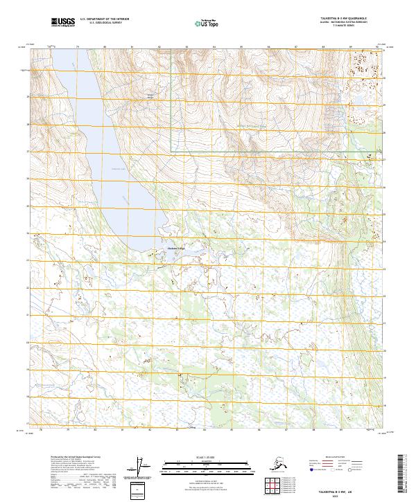
2023 Map of Talkeetna B-3 NW
USGS Topo · Published 2023About this map
Chelatna Lodge sits as a primary point of human activity in this remote region, positioned near the southern tip of the expansive Chelatna Lake. This modern survey illustrates the meeting point of high alpine terrain and intricate wetlands, where the foothills of the Alaska Range descend into the swampy lowlands of the Susitna River basin. Portions of Denali National Park occupy the northeastern quadrant, protecting a landscape defined by glacier-fed drainages like Lake Creek and Treasure Creek. The map provides a detailed view of the complex hydrological network typical of this part of Alaska, featuring the winding paths of Sunflower Creek, Cottonwood Creek, and Camp Creek as they traverse the glacial till and muskeg flats south of the higher peaks.
Find a feature on this map
15 named features on this map. Tap any name to fly to it.
Don’t see what you’re looking for? This feature index may not catch every label — zoom into the map to look around manually.
Map Details
Editions of this 2023 Talkeetna B-3 NW Map
This is the sole edition of this map. No revisions or reprints were ever made.
Other maps of this area

1950 · Talkeetna
USGS Topo · 1:250,000

1951 · Talkeetna
USGS Topo · 1:250,000

1954 · Talkeetna B-4
USGS Topo · 1:63,360

1954 · Talkeetna B-3
USGS Topo · 1:63,360

1958 · Talkeetna C-4
USGS Topo · 1:63,360

1958 · Talkeetna C-3
USGS Topo · 1:63,360

1958 · Talkeetna
USGS Topo · 1:250,000

1965 · Talkeetna
USGS Topo · 1:250,000
2013 · Talkeetna B-3 SE
USGS Topo · 1:25,000
2013 · Talkeetna B-3 SW
USGS Topo · 1:25,000