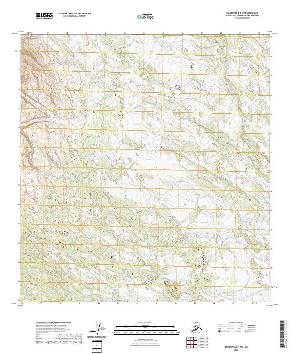
2023 Map of Talkeetna B-3 SW
USGS Topo · Published 2023About this map
Lake Creek and its many tributaries define this section of the Matanuska-Susitna region, where the drainage network creates a complex landscape of wetlands and watercourses. The map documents a pristine hydrologic system including Sunflower Creek and Home Creek, which weave through the expansive lowlands. This survey illustrates the natural state of the Alaskan interior before modern development, focusing on the intricate waterways that have long served as primary corridors for movement through the bush.
Find a feature on this map
11 named features on this map. Tap any name to fly to it.
Don’t see what you’re looking for? This feature index may not catch every label — zoom into the map to look around manually.
Map Details
Editions of this 2023 Talkeetna B-3 SW Map
This is the sole edition of this map. No revisions or reprints were ever made.
Other maps of this area

1950 · Talkeetna
USGS Topo · 1:250,000

1951 · Talkeetna
USGS Topo · 1:250,000

1954 · Talkeetna A-3
USGS Topo · 1:63,360

1954 · Talkeetna B-4
USGS Topo · 1:63,360

1954 · Talkeetna A-4
USGS Topo · 1:63,360

1954 · Talkeetna B-3
USGS Topo · 1:63,360

1958 · Talkeetna
USGS Topo · 1:250,000

1965 · Talkeetna
USGS Topo · 1:250,000
2013 · Talkeetna B-3 SE
USGS Topo · 1:25,000
2013 · Talkeetna B-3 SW
USGS Topo · 1:25,000