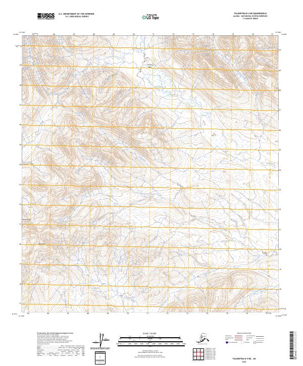
2023 Map of Talkeetna B-4 NE
USGS Topo · Published 2023About this map
Mt Kliskon stands as a prominent landmark in this segment of the Alaska Range, where a complex network of high-latitude drainage systems shapes the landscape of the Matanuska-Susitna Borough. The drainage pattern is defined by the convergence of various waterways such as Clearwater Creek, Rice Creek, and Fish Creek, which flow through deep glacial valleys. Northward, the terrain opens into the Sunflower Basin, a significant topographical depression fed by Sunflower Creek and its neighboring Bonanza Creek. The absence of developed roads or settlements in this 2023 survey emphasizes the wilderness character of the region, where the primary features are defined by water and ice. For researchers, the map provides a detailed view of these hydrological corridors, including the winding paths of Wolverine Creek and Slate Creek, which are critical for understanding the natural geography of this undeveloped section of Alaska.
Find a feature on this map
19 named features on this map. Tap any name to fly to it.
Don’t see what you’re looking for? This feature index may not catch every label — zoom into the map to look around manually.
Map Details
Editions of this 2023 Talkeetna B-4 NE Map
This is the sole edition of this map. No revisions or reprints were ever made.
Other maps of this area

1950 · Talkeetna
USGS Topo · 1:250,000

1951 · Talkeetna
USGS Topo · 1:250,000

1954 · Talkeetna B-4
USGS Topo · 1:63,360

1954 · Talkeetna B-3
USGS Topo · 1:63,360

1958 · Talkeetna C-4
USGS Topo · 1:63,360

1958 · Talkeetna C-3
USGS Topo · 1:63,360

1958 · Talkeetna
USGS Topo · 1:250,000

1965 · Talkeetna
USGS Topo · 1:250,000
2013 · Talkeetna B-3 SW
USGS Topo · 1:25,000
2014 · Talkeetna C-3 SW
USGS Topo · 1:25,000