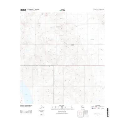
2014 Map of Talkeetna C-3 SW
USGS Topo · Published 2014About this map
Denali National Park encompasses the majority of this landscape, where the high-altitude terrain is defined by dramatic elevation changes and glacial activity. The northeastern portion of the map is dominated by the Kahiltna Glacier, a massive ice feature that shapes the local hydrology and topography. In the southwest, the waters of Chelatna Lake sit at the base of steep slopes, serving as a primary collection point for the surrounding drainage systems. The map traces the paths of alpine waterways such as Coffee Cr and Snowslide Cr, which cut through the technical contouring of the Alaska Range. This 2014 survey by the U.S. Geological Survey captures a region of wilderness where the absence of roads or permanent settlements highlights the protected and inaccessible nature of the park's interior.
Find a feature on this map
7 named features on this map. Tap any name to fly to it.
Don’t see what you’re looking for? This feature index may not catch every label — zoom into the map to look around manually.
Map Details
Editions of this 2014 Talkeetna C-3 SW Map
This is the sole edition of this map. No revisions or reprints were ever made.
Other maps of this area

1950 · Talkeetna
USGS Topo · 1:250,000

1951 · Talkeetna
USGS Topo · 1:250,000

1954 · Talkeetna B-4
USGS Topo · 1:63,360

1954 · Talkeetna B-3
USGS Topo · 1:63,360

1958 · Talkeetna C-4
USGS Topo · 1:63,360

1958 · Talkeetna C-3
USGS Topo · 1:63,360

1958 · Talkeetna
USGS Topo · 1:250,000

1965 · Talkeetna
USGS Topo · 1:250,000
2014 · Talkeetna C-3 NW
USGS Topo · 1:25,000
2014 · Talkeetna C-3 NE
USGS Topo · 1:25,000