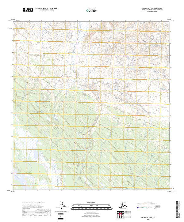
2023 Map of Talkeetna B-4 SE
USGS Topo · Published 2023About this map
The Yentna River flows through the southwestern corner of this landscape, marking a transition into a dense network of watercourses and wetlands. Moving northward, the terrain rises toward Fairview Mtn, where a series of steep gulches including Chicago Gulch, Wagner Gulch, and Orrin Gulch carve into the slopes. These features, along with Mills Creek, suggest a history of prospecting or small-scale mineral exploration common in this part of the Matanuska-Susitna Borough.
Find a feature on this map
23 named features on this map. Tap any name to fly to it.
Don’t see what you’re looking for? This feature index may not catch every label — zoom into the map to look around manually.
Map Details
Editions of this 2023 Talkeetna B-4 SE Map
This is the sole edition of this map. No revisions or reprints were ever made.
Other maps of this area

1950 · Talkeetna
USGS Topo · 1:250,000

1951 · Talkeetna
USGS Topo · 1:250,000

1954 · Talkeetna A-3
USGS Topo · 1:63,360

1954 · Talkeetna B-4
USGS Topo · 1:63,360

1954 · Talkeetna A-4
USGS Topo · 1:63,360

1954 · Talkeetna B-3
USGS Topo · 1:63,360

1958 · Talkeetna
USGS Topo · 1:250,000

1965 · Talkeetna
USGS Topo · 1:250,000
2013 · Talkeetna B-3 SW
USGS Topo · 1:25,000
2014 · Talkeetna B-3 NW
USGS Topo · 1:25,000