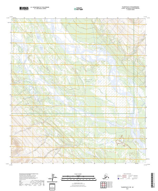
2023 Map of Talkeetna B-4 SW
USGS Topo · Published 2023About this map
The East Fork Yentna River dominates this portion of the Susitna Valley, where the river's braided channels and wide gravel bars illustrate the dynamic nature of glacial runoff in the Alaska Range foothills. The landscape is a complex network of wetlands and minor tributaries, including the West Fork Yentna River and Fourth of July Creek. A significant portion of the eastern territory is protected within the Denali National Preserve, maintaining a wilderness character largely untouched by permanent road infrastructure. Higher elevations are marked by seasonal drainages such as Fish Creek and Rich Creek, which feed into the primary river systems. Scattered water bodies like the Midway Lakes provide critical habitat amidst the shifting river plains, offering a detailed look at the hydrology of the Matanuska-Susitna region.
Find a feature on this map
1 named feature on this map. Tap any name to fly to it.
Don’t see what you’re looking for? This feature index may not catch every label — zoom into the map to look around manually.
Map Details
Editions of this 2023 Talkeetna B-4 SW Map
This is the sole edition of this map. No revisions or reprints were ever made.
Other maps of this area

1950 · Talkeetna
USGS Topo · 1:250,000

1951 · Talkeetna
USGS Topo · 1:250,000

1954 · Talkeetna B-4
USGS Topo · 1:63,360

1954 · Talkeetna A-4
USGS Topo · 1:63,360

1958 · Talkeetna A-5
USGS Topo · 1:63,360

1958 · Talkeetna B-5
USGS Topo · 1:63,360

1958 · Talkeetna
USGS Topo · 1:250,000

1965 · Talkeetna
USGS Topo · 1:250,000
2017 · Talkeetna B-4 NE
USGS Topo · 1:25,000
2017 · Talkeetna B-4 SW
USGS Topo · 1:25,000