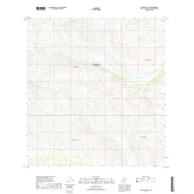
2017 Map of Talkeetna B-5 SW
USGS Topo · Published 2017About this map
Denali National Preserve encompasses the central portion of this remote Alaska interior landscape, where high-elevation terrain is defined by steep relief and drainage basins. The southern edge of the quadrangle is marked by the Kichatna River, while the upper sections are carved by the eastern and western branches of Fourth of July Creek. This 2017 survey reflects the protected wilderness character of the Matanuska-Susitna region, documenting a landscape devoid of permanent human settlements or roads. The map serves as a detailed record of glacial or post-glacial topography, with contour lines illustrating the sharp transition from river valleys to the high ridges of the preserve, essential for understanding the hydrology of the Fourth of July Cr system before it joins larger regional waterways.
Find a feature on this map
8 named features on this map. Tap any name to fly to it.
Don’t see what you’re looking for? This feature index may not catch every label — zoom into the map to look around manually.
Map Details
Editions of this 2017 Talkeetna B-5 SW Map
This is the sole edition of this map. No revisions or reprints were ever made.
Other maps of this area

1950 · Talkeetna
USGS Topo · 1:250,000

1951 · Talkeetna
USGS Topo · 1:250,000

1958 · Talkeetna A-6
USGS Topo · 1:63,360

1958 · Talkeetna A-5
USGS Topo · 1:63,360

1958 · Talkeetna B-5
USGS Topo · 1:63,360

1958 · Talkeetna B-6
USGS Topo · 1:63,360

1958 · Talkeetna
USGS Topo · 1:250,000

1965 · Talkeetna
USGS Topo · 1:250,000
2017 · Talkeetna B-5 NE
USGS Topo · 1:25,000
2017 · Talkeetna B-5 SE
USGS Topo · 1:25,000