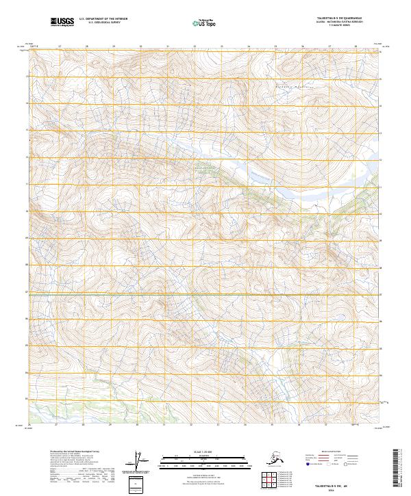
2024 Map of Talkeetna B-5 SW
USGS Topo · Published 2024About this map
Denali National Preserve encompasses a significant portion of this landscape, where the dramatic peaks of the Kichatna Mountains dominate the horizon. This 2024 survey documents the remote drainage systems within the Matanuska-Susitna Borough, specifically focusing on the area where the Fourth of July Creek winds through the northern valleys. To the south, the Kichatna River skirts the edge of the quadrangle, illustrating the complex glacial and fluvial topography of this protected interior region. The map provides a clear look at the township and range boundaries, such as t26n r17w and t26n r16w, which define the administrative grid across this largely roadless wilderness.
Find a feature on this map
8 named features on this map. Tap any name to fly to it.
Don’t see what you’re looking for? This feature index may not catch every label — zoom into the map to look around manually.
Map Details
Editions of this 2024 Talkeetna B-5 SW Map
This is the sole edition of this map. No revisions or reprints were ever made.
Other maps of this area

1950 · Talkeetna
USGS Topo · 1:250,000

1951 · Talkeetna
USGS Topo · 1:250,000

1958 · Talkeetna A-6
USGS Topo · 1:63,360

1958 · Talkeetna A-5
USGS Topo · 1:63,360

1958 · Talkeetna B-5
USGS Topo · 1:63,360

1958 · Talkeetna B-6
USGS Topo · 1:63,360

1958 · Talkeetna
USGS Topo · 1:250,000

1965 · Talkeetna
USGS Topo · 1:250,000
2017 · Talkeetna B-5 NE
USGS Topo · 1:25,000
2017 · Talkeetna B-5 SE
USGS Topo · 1:25,000