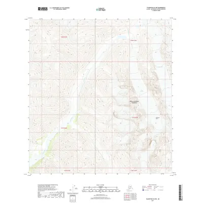
2017 Map of Talkeetna B-6 NW
USGS Topo · Published 2017About this map
Denali National Preserve encompasses the eastern half of this terrain, where the high-altitude landscape is defined by the massive ice and rock formations of the Alaska Range. The glacial system is a primary driver of the topography, with the Tatina Glacier and the distinctively named Cul-de-sac Glacier feeding the headwaters of the Tatina River. This river corridor carves through the mountains as it flows southwest, creating a natural valley amidst the steep elevations. The Cathedral Spires dominate the southeastern portion of the map, their jagged profiles illustrating the intense geological activity that characterizes this portion of the Matanuska-Susitna Borough. This 2017 survey serves as a precise record of glacial positions and hydrologic patterns before further environmental shifts alter these remote features.
Find a feature on this map
11 named features on this map. Tap any name to fly to it.
Don’t see what you’re looking for? This feature index may not catch every label — zoom into the map to look around manually.
Map Details
Editions of this 2017 Talkeetna B-6 NW Map
This is the sole edition of this map. No revisions or reprints were ever made.
Other maps of this area

1949 · McGrath
USGS Topo · 1:250,000

1950 · McGrath
USGS Topo · 1:250,000

1950 · Talkeetna
USGS Topo · 1:250,000

1951 · Talkeetna
USGS Topo · 1:250,000

1958 · Talkeetna B-6
USGS Topo · 1:63,360

1958 · Talkeetna C-6
USGS Topo · 1:63,360

1958 · McGrath B-1
USGS Topo · 1:63,360

1958 · McGrath C-1
USGS Topo · 1:63,360

1958 · Talkeetna
USGS Topo · 1:250,000

1958 · McGrath
USGS Topo · 1:250,000