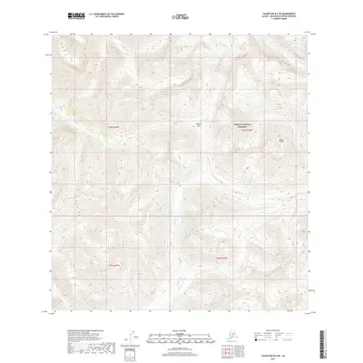
2017 Map of Talkeetna B-6 SW
USGS Topo · Published 2017About this map
Denali National Preserve encompasses a significant portion of this high-elevation wilderness within the Alaska Range. The landscape is defined by the convergence of several major drainage systems, including the Earl River, Morris Cr, and Threemile Cr. These glacial-fed waterways carve deep through the terrain, with Simpson Pass providing a critical high-altitude corridor between the western and eastern slopes. In the northeastern corner of the map, the Kichatna River begins its course, marking a primary drainage route for the surrounding peaks. This 2017 survey details a remote area devoid of permanent human settlement or infrastructure, focusing instead on the complex topography and natural boundaries of the national preserve and surrounding township grids.
Find a feature on this map
11 named features on this map. Tap any name to fly to it.
Don’t see what you’re looking for? This feature index may not catch every label — zoom into the map to look around manually.
Map Details
Editions of this 2017 Talkeetna B-6 SW Map
This is the sole edition of this map. No revisions or reprints were ever made.
Other maps of this area

1949 · McGrath
USGS Topo · 1:250,000

1950 · McGrath
USGS Topo · 1:250,000

1950 · Talkeetna
USGS Topo · 1:250,000

1951 · Talkeetna
USGS Topo · 1:250,000

1958 · Talkeetna A-6
USGS Topo · 1:63,360

1958 · Talkeetna B-6
USGS Topo · 1:63,360

1958 · McGrath B-1
USGS Topo · 1:63,360

1958 · McGrath A-1
USGS Topo · 1:63,360

1958 · Talkeetna
USGS Topo · 1:250,000

1958 · McGrath
USGS Topo · 1:250,000