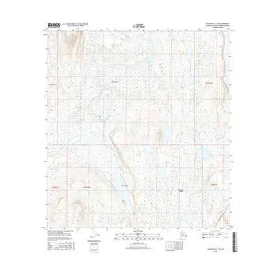
2016 Map of Talkeetna C-1 SW
USGS Topo · Published 2016About this map
Petersville and Trapper Creek anchor the human presence in this 2016 survey of the Matanuska-Susitna region. The landscape is dominated by the braided glacial waters of the Tokositna River and the Ruth River, which carve through a mosaic of wetlands and rising elevation. Modern transportation infrastructure is represented by the Parks Highway clipping the southeastern corner, serving as the primary artery connecting the interior. Between the settlements, Swan Lake sits amidst a complex network of smaller water bodies and marshes that characterize the low-lying basins. The map illustrates the transition from the relatively accessible highway corridor to the more secluded terrain of the mining district and river valleys, providing a precise record of late-frontier Alaskan land use and natural hydrology.
Find a feature on this map
12 named features on this map. Tap any name to fly to it.
Don’t see what you’re looking for? This feature index may not catch every label — zoom into the map to look around manually.
Map Details
Editions of this 2016 Talkeetna C-1 SW Map
This is the sole edition of this map. No revisions or reprints were ever made.
Other maps of this area

1950 · Talkeetna
USGS Topo · 1:250,000

1951 · Talkeetna
USGS Topo · 1:250,000

1951 · Talkeetna B-1
USGS Topo · 1:63,360

1951 · Talkeetna C-1
USGS Topo · 1:63,360

1954 · Talkeetna B-2
USGS Topo · 1:63,360

1958 · Talkeetna B-1
USGS Topo · 1:63,360

1958 · Talkeetna C-1
USGS Topo · 1:63,360

1958 · Talkeetna C-2
USGS Topo · 1:63,360

1958 · Talkeetna
USGS Topo · 1:250,000

1965 · Talkeetna
USGS Topo · 1:250,000