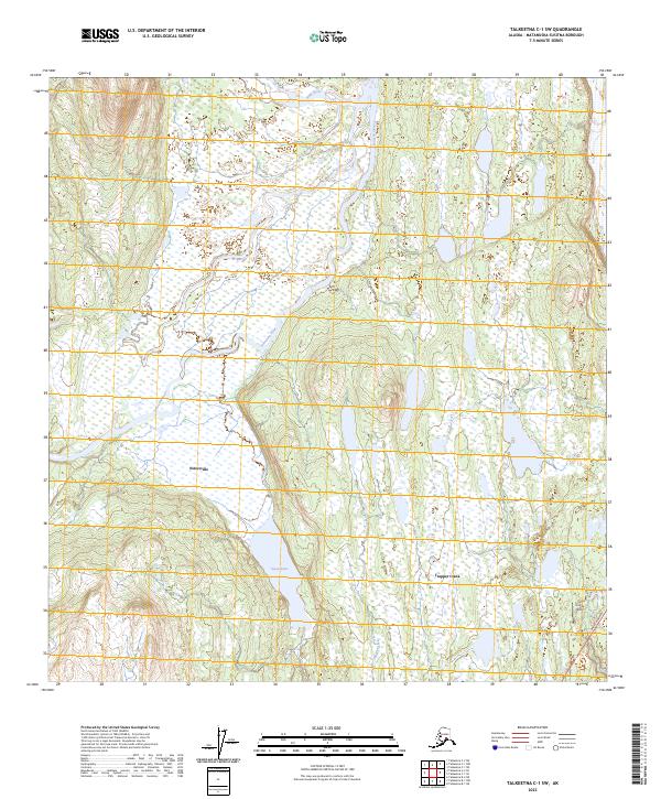
2023 Map of Talkeetna C-1 SW
USGS Topo · Published 2023About this map
The settlement of Petersville and the residential spread of Trapper Creek anchor this modern survey of the Matanuska-Susitna region. The landscape is defined by the braided courses of the Ruth River and Tokositna River, which feed into an intricate network of wetlands and small water bodies. In the southern portion of the map, Swan Lake sits west of the community hub where the Parks Highway serves as the primary artery for travel and transport. Local infrastructure is further evidenced by the For Crosby Airport near the eastern edge. The map illustrates a transitional subarctic environment where sparse development meets a vast watery wilderness, reflecting the modern settlement patterns of this corridor between the Talkeetna Mountains and the Alaska Range.
Find a feature on this map
14 named features on this map. Tap any name to fly to it.
Don’t see what you’re looking for? This feature index may not catch every label — zoom into the map to look around manually.
Map Details
Editions of this 2023 Talkeetna C-1 SW Map
This is the sole edition of this map. No revisions or reprints were ever made.
Other maps of this area

1950 · Talkeetna
USGS Topo · 1:250,000

1951 · Talkeetna
USGS Topo · 1:250,000

1951 · Talkeetna B-1
USGS Topo · 1:63,360

1951 · Talkeetna C-1
USGS Topo · 1:63,360

1954 · Talkeetna B-2
USGS Topo · 1:63,360

1958 · Talkeetna B-1
USGS Topo · 1:63,360

1958 · Talkeetna C-1
USGS Topo · 1:63,360

1958 · Talkeetna C-2
USGS Topo · 1:63,360

1958 · Talkeetna
USGS Topo · 1:250,000

1965 · Talkeetna
USGS Topo · 1:250,000