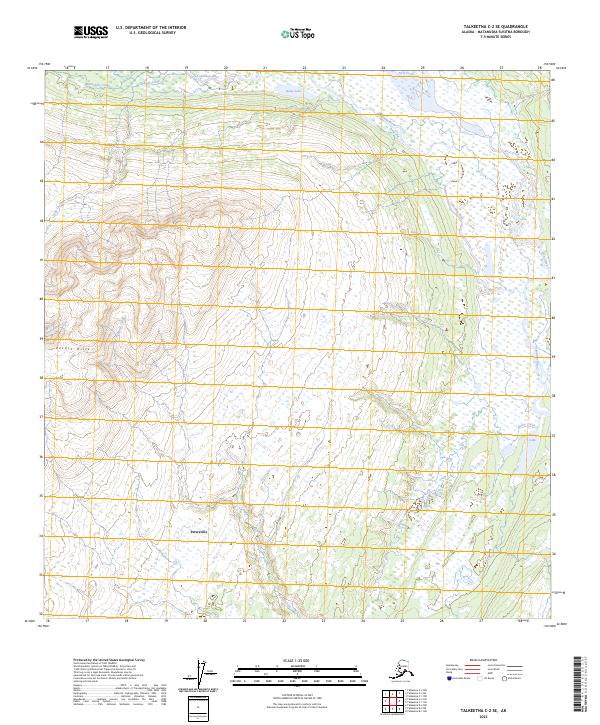
2023 Map of Talkeetna C-2 SE
USGS Topo · Published 2023About this map
Petersville sits at the base of the Peters Hills, marking a pocket of settlement in the Matanuska-Susitna region where the landscape transitions from high ridgelines to expansive drainage basins. The northern reach of the map is defined by the broad path of the Tokositna River, which receives various tributaries including Ramsdyke Creek and Long Creek. The southeastern quadrant reveals a complex system of wetlands and small water bodies, anchored by Bunco Lake and the winding Bunco Creek. This 2023 survey by the U.S. Geological Survey illustrates the relationship between the elevated terrain of the hills and the lowland water systems like Home Lake and First Creek that drain toward the glacial river valleys.
Find a feature on this map
14 named features on this map. Tap any name to fly to it.
Don’t see what you’re looking for? This feature index may not catch every label — zoom into the map to look around manually.
Map Details
Editions of this 2023 Talkeetna C-2 SE Map
This is the sole edition of this map. No revisions or reprints were ever made.
Other maps of this area

1950 · Talkeetna
USGS Topo · 1:250,000

1951 · Talkeetna
USGS Topo · 1:250,000

1951 · Talkeetna B-1
USGS Topo · 1:63,360

1951 · Talkeetna C-1
USGS Topo · 1:63,360

1954 · Talkeetna B-2
USGS Topo · 1:63,360

1958 · Talkeetna B-1
USGS Topo · 1:63,360

1958 · Talkeetna C-1
USGS Topo · 1:63,360

1958 · Talkeetna C-2
USGS Topo · 1:63,360

1958 · Talkeetna
USGS Topo · 1:250,000

1965 · Talkeetna
USGS Topo · 1:250,000