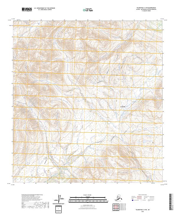
2023 Map of Talkeetna C-2 SW
USGS Topo · Published 2023About this map
The Peters Hills and Dutch Hills dominate this portion of the Alaska Range, where a network of steep gulches and creek beds historically drew prospectors to the Matanuska-Susitna region. The settlement of Petersville serves as the focal point for the area's transportation, connected by the primary Petersville Road which transitions into more specialized routes like Nugget Creek Road. This landscape is defined by the drainage patterns of Peters Creek and its many tributaries, including Poorman Creek and Willow Creek. Evidence of aviation's role in accessing this backcountry is found at Nugget Bench Airport, situated on a plateau above the confluence of Thunder Creek and Nugget Creek. The map provides a detailed look at the drainage systems of Cottonwood Creek and Cache Creek, highlighting the complex topography that shaped early 20th-century mining and modern recreation.
Find a feature on this map
36 named features on this map. Tap any name to fly to it.
Don’t see what you’re looking for? This feature index may not catch every label — zoom into the map to look around manually.
Map Details
Editions of this 2023 Talkeetna C-2 SW Map
This is the sole edition of this map. No revisions or reprints were ever made.
Other maps of this area

1950 · Talkeetna
USGS Topo · 1:250,000

1951 · Talkeetna
USGS Topo · 1:250,000

1954 · Talkeetna B-3
USGS Topo · 1:63,360

1954 · Talkeetna B-2
USGS Topo · 1:63,360

1958 · Talkeetna C-2
USGS Topo · 1:63,360

1958 · Talkeetna C-3
USGS Topo · 1:63,360

1958 · Talkeetna
USGS Topo · 1:250,000

1965 · Talkeetna
USGS Topo · 1:250,000
1994 · Talkeetna B-2
USGS Topo · 1:63,360
2013 · Talkeetna B-2 NE
USGS Topo · 1:25,000