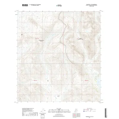
2017 Map of Talkeetna C-4 SE
USGS Topo · Published 2017About this map
The Alaska Range defines the high-elevation terrain of this 2017 survey, where the administrative boundaries of Denali National Park and Denali National Preserve meet. This landscape is shaped by a dense network of watercourses, including the southward-flowing Colorado Cr and Sunflower Cr, which drains the high-altitude Sunflower Basin. The drainage patterns here are steep and complex, evidenced by features such as Stern Gulch and Snowslide Cr.
Find a feature on this map
14 named features on this map. Tap any name to fly to it.
Don’t see what you’re looking for? This feature index may not catch every label — zoom into the map to look around manually.
Map Details
Editions of this 2017 Talkeetna C-4 SE Map
This is the sole edition of this map. No revisions or reprints were ever made.
Other maps of this area

1950 · Talkeetna
USGS Topo · 1:250,000

1951 · Talkeetna
USGS Topo · 1:250,000

1954 · Talkeetna B-4
USGS Topo · 1:63,360

1954 · Talkeetna B-3
USGS Topo · 1:63,360

1958 · Talkeetna C-4
USGS Topo · 1:63,360

1958 · Talkeetna C-3
USGS Topo · 1:63,360

1958 · Talkeetna
USGS Topo · 1:250,000

1965 · Talkeetna
USGS Topo · 1:250,000
2014 · Talkeetna C-3 NW
USGS Topo · 1:25,000
2014 · Talkeetna C-3 SW
USGS Topo · 1:25,000