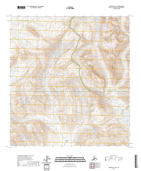
2023 Map of Talkeetna C-4 SE
USGS Topo · Published 2023About this map
The Alaska Range looms over this remote landscape where the boundaries of Denali National Preserve and Denali National Park meet. The terrain is defined by a dense network of high-altitude drainages, including Sunflower Creek, Cripple Creek, and Colorado Creek, which carve through deep valleys and basins. To the southeast, the shoreline of Chelatna Lake marks a significant transition in the topography, fed by glacial runoff and mountain streams like Easter Creek.
Find a feature on this map
16 named features on this map. Tap any name to fly to it.
Don’t see what you’re looking for? This feature index may not catch every label — zoom into the map to look around manually.
Map Details
Editions of this 2023 Talkeetna C-4 SE Map
This is the sole edition of this map. No revisions or reprints were ever made.
Other maps of this area

1950 · Talkeetna
USGS Topo · 1:250,000

1951 · Talkeetna
USGS Topo · 1:250,000

1954 · Talkeetna B-4
USGS Topo · 1:63,360

1954 · Talkeetna B-3
USGS Topo · 1:63,360

1958 · Talkeetna C-4
USGS Topo · 1:63,360

1958 · Talkeetna C-3
USGS Topo · 1:63,360

1958 · Talkeetna
USGS Topo · 1:250,000

1965 · Talkeetna
USGS Topo · 1:250,000
2014 · Talkeetna C-3 NW
USGS Topo · 1:25,000
2014 · Talkeetna C-3 SW
USGS Topo · 1:25,000