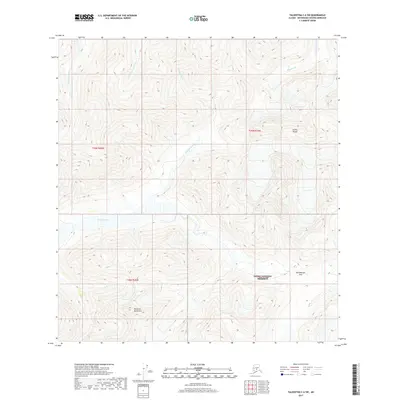
2017 Map of Talkeetna C-6 SW
USGS Topo · Published 2017About this map
The Denali National Preserve encompasses a significant portion of this wilderness landscape, where the southern reaches of the Alaska Range meet the sharp elevations of the Kichatna Mountains. This 2017 survey details a complex hydrologic network defined by the Dillinger River, which cuts through the center of the sheet, and the Little Tonzona River in the northwest. High-altitude crossings like Shellabarger Pass indicate the natural corridors used to navigate this mountain terrain. The map serves as a primary record of the glacial-fed waterways including Pingston Cr and the Big Salmon Fork, illustrating the high-alpine environment before the seasonal shifts of the early 21st century. The lack of man-made infrastructure emphasizes the preservation of this remote interior region.
Find a feature on this map
12 named features on this map. Tap any name to fly to it.
Don’t see what you’re looking for? This feature index may not catch every label — zoom into the map to look around manually.
Map Details
Editions of this 2017 Talkeetna C-6 SW Map
This is the sole edition of this map. No revisions or reprints were ever made.
Other maps of this area

1949 · McGrath
USGS Topo · 1:250,000

1950 · McGrath
USGS Topo · 1:250,000

1950 · Talkeetna
USGS Topo · 1:250,000

1951 · Talkeetna
USGS Topo · 1:250,000

1958 · Talkeetna B-6
USGS Topo · 1:63,360

1958 · Talkeetna C-6
USGS Topo · 1:63,360

1958 · McGrath B-1
USGS Topo · 1:63,360

1958 · McGrath C-1
USGS Topo · 1:63,360

1958 · Talkeetna
USGS Topo · 1:250,000

1958 · McGrath
USGS Topo · 1:250,000