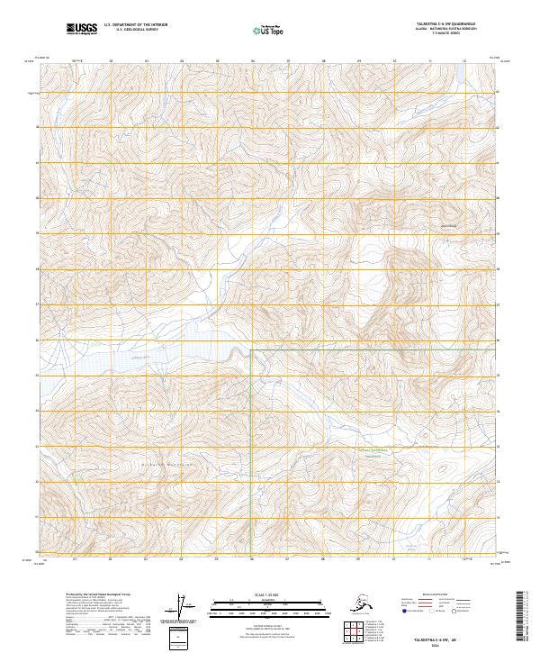
2024 Map of Talkeetna C-6 SW
USGS Topo · Published 2024About this map
The Alaska Range and the Kichatna Mountains converge in this high-altitude interior region, where the glacial landscape remains remarkably intact. A significant portion of the southeastern quadrant falls within the Denali National Preserve, protecting a complex system of peaks and valleys. The drainage patterns here are defined by the Dillinger River, which winds through the central valley, and the Big Salmon Fork, alongside smaller watercourses like Little Tonzona River and Pingston Creek. Evidence of active glaciation is visible at the Cul-de-sac Glacier, while the Shellabarger Pass provides a natural corridor through the surrounding high peaks. This 2024 survey documents the modern topography of a wilderness area defined more by its geological features and hydrological systems than by human infrastructure.
Find a feature on this map
13 named features on this map. Tap any name to fly to it.
Don’t see what you’re looking for? This feature index may not catch every label — zoom into the map to look around manually.
Map Details
Editions of this 2024 Talkeetna C-6 SW Map
This is the sole edition of this map. No revisions or reprints were ever made.
Other maps of this area

1949 · McGrath
USGS Topo · 1:250,000

1950 · McGrath
USGS Topo · 1:250,000

1950 · Talkeetna
USGS Topo · 1:250,000

1951 · Talkeetna
USGS Topo · 1:250,000

1958 · Talkeetna B-6
USGS Topo · 1:63,360

1958 · Talkeetna C-6
USGS Topo · 1:63,360

1958 · McGrath B-1
USGS Topo · 1:63,360

1958 · McGrath C-1
USGS Topo · 1:63,360

1958 · Talkeetna
USGS Topo · 1:250,000

1958 · McGrath
USGS Topo · 1:250,000